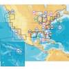
010-C1024-10 Bluechart G2 HUS401SBermuda Data Card
Model: 010-C1024-10 Brand: Garmin
Provides coverage of Bermuda detailing Saint George's Island and Harbour, Harrington Sound, Somerset Island, the Great and Little Sounds, Hamilton Island, and Castle Harbour. See your surroundings more clearly with BlueChart g2 data. With BlueChart g2, you'll get detailed marine cartography that provides convenient viewing of nautical content. BlueChart g2 allows you to see your vessel's precise, on-chart position in relation to naviads, coastal features, anchorages, obstructions, waterways, restricted areas and more. You will also have access to detailed mapping capabilities that include Safety Shading , Fishing Charts , smooth data transition between zoom levels, harmonious transition across chart borders, and reduction of chart discontinuities. « less
Product Specification
-
Universal Product Identifiers
Part Numbers: 010-C1024-10, 10807261, 35819, GAR010C102410GTIN: 00753759095543
Related Products
-
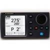
NAVPILOT 700 Autopilot
-
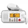
IC-M412 Fixed Mount VHF Marine Radio
-
CF/674P+ Boston-ny Plat + on CF
-
CF/637P+ NJ & Deleware Plat+ on CF
-
2744.91 FBRS 2744 Battery Replacement Service
-
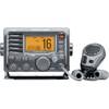
M504 Gray VHF Radio with Hailer
-
Adventure Medical 0115-2000 Kit Marine 2000
-
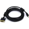
15ft HDMI to DVI Cable HDMI DVI Cord
-
Serial cable - (DB-37) - M - (DB-37) - F - 10 ft - PC
-
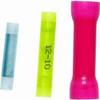
Butt CONNECTOR, Single CRIMP, Nylon Insulated Blue, 16-14, 100 Pack
-
B75-0-M Broadband Chirp 0 Degree Tilt, No CONNECTOR, Depth & Temperature Thru-Hull Tilted
-
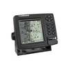
GlobalMap 4800M - Marine GPS receiver - 5" monochrome - 480 x 480