010-C1025-10 Bluechart G2 HEU718LMediterranean Sea Data Card
Model: 010-C1025-10 Brand: Garmin
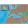
See your surroundings more clearly with BlueChart g2 data. With BlueChart g2, you'll get detailed marine cartography that provides convenient viewing of nautical content. BlueChart g2 allows you to see your vessel's precise, on-chart position in relation to naviads, coastal features, anchorages, obstructions, waterways, restricted areas and more. You will also have access to detailed mapping capabilities that include Safety Shading, Fishing Charts, smooth data transition between zoom levels, harmonious transition across chart borders, and reduction of chart discontinuities. Covers: Detailed offshore coastal coverage of the Mediterranean Sea in its entirety. Coverage features the Strait of Gibraltar, the Balearic Islands, the French Riviera, Corsica, Sardinia, Sicily, the Adriatic Sea, the Greek Islands, the Aegean Sea, the Dardanelles and Bosporus Straits, the Sea of Marmara, Cyprus, the Suez Canal, Tripoli and Algiers Harbors, and the Gulfs of Gabes and Tunisia. « less
Product Specification
-
Universal Product Identifiers
Part Numbers: 010-C1025-10, 10807287, 35821GTIN: 00753759096243
Related Products
-
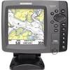
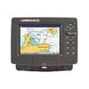
700 Series 786ci - Marine Chartplotter - 5" color - 640 x 640
-
ME-C005 C-Card Format - Caspian Sea
-
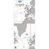
Max EW-M227 W3 Norhtwest European Coasts-MAX
-
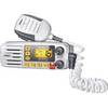
Solara DSC Fixed Mount VHF 2-Way Marine Radio White
-
ACR Pull-Pin Vest Strobe 3961.1
-
Marine Naviled Pro Port Navigation Light
-
30ft 24AWG Cat5e 350MHz UTP Bare Copper Ethernet Network Cable - Blue
-
10ft 22AWG 3-RCA Component Video Coaxial Cable (RG-59/U) - Black
-
SmartPlug BF50 50 Amp Boatside Connector
-
CA50/200 12M HIGH-PERFORMANCE Bronze Thru-Hull Transducer
-
E55052 - SeaTalk hs Network Cable, 20m
-
GlobalMap 7300C HD - Marine GPS receiver - 7" color - 640 x 480