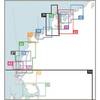
3205 Lake Mead
Model: 3205 Brand: Fish-n-Map
FISH-N-MAP UNDERWATER TOPOGRAPHY MAPSMade of waterproof, tear resistant plastic. Features include: underwater depth contours, fish locations, latitude and longitude for GPS, multiple freshwater lakes on one map, boat ramps, recreational facilities and much more.
Product Specification
-
Universal Product Identifiers
Part Numbers: 032058, 234610, 3205GTIN: 00761428032058
Related Products
-
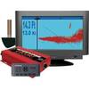
37594 Escort Sonar Module with Thru Hull, Keypad, Video, A
-
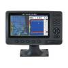
ELITE4X DSi Sonar
-
Max EN-M076 W21 Belgium Inland-River Rhein-MAX
-
Chart Master Pro Combo - Internal Antenna U1-CHRT-PROI
-
WPC048; Champlain Canal Ed 1
-
The Nautical Chart: A Novel of Adventure [Book]
-
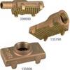
Ver. Pump Strainer f/1-1/4" Pipe 135806
-
Cat6a Ethernet Cable | 2ft | Orange | Network | 10 Gigabit
-
75ft 24AWG Cat6 550mhz UTP Ethernet Bare Copper Network Cable - Orange
-
6ft 28AWG HDMI to M1-D (pd) Cable - Black
-
6ft DB-25(IEEE-1284) Male to Mini/Micro Centronic 36(hpcn36) Male Cable [IE]
-
Automatic Generator Start 809-0915 (Require Scp System) C16523