5202; Map-Apache/Saguaro/Canyon Res
Model: 5202 Brand: Fish-n-Map
FISH-N-MAP UNDERWATER TOPOGRAPHY MAPSMade of waterproof, tear resistant plastic. Features include: underwater depth contours, fish locations, latitude and longitude for GPS, multiple freshwater lakes on one map, boat ramps, recreational facilities and much more.
Product Specification
-
Universal Product Identifiers
Part Numbers: 249840, 5202GTIN: 00761428052025
Related Products
-
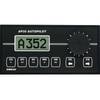
AP35-19 Autopilot with AP35, J300X, Rudder Feedback RF300, HPU-200 sap3519
-
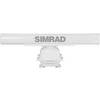
Tx25s-1 25KW Open Array Radar with 7' Antenna
-
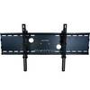
Adjustable Tilting Wall Mount Bracket for LCD LED Plasma
-
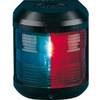
Navigation Light for Bulk Head Mounting , Starboard
-
Fuel Line Connector Johnson Evinrude Female Fitting 2-Prong
-
HBL61CM56 Adapter 50A 12V Female to 30A Male
-
127-05 NAC-FRD2FBL Fem. Red to Fem
-
6 Inch Power Mount for Northstar & Simrad Open Array with Light Option (Aft Leaning) PMA-6NO-8L ( PMA-57-M1 + ADA-R1)
-
HDS-8 - Marine Chartplotter - 8" color - 800 x 600
-
1ft 24AWG Cat5e 350MHz UTP Bare Copper Ethernet Network Cable - Red
-
2ft 24AWG Cat6 550mhz UTP Ethernet Bare Copper Network Cable - Purple
-
zumo 550 - Motorcycle GPS receiver - 3.5" color - 320 x 240