8264; Map-Clearlake/Lake Berryessa
Model: 8264 Brand: Fish-n-Map
FISH-N-MAP UNDERWATER TOPOGRAPHY MAPSMade of waterproof, tear resistant plastic. Features include: underwater depth contours, fish locations, latitude and longitude for GPS, multiple freshwater lakes on one map, boat ramps, recreational facilities and much more.
Product Specification
-
Universal Product Identifiers
Part Numbers: 235450, 8264, MSI432211GTIN: 00761428082640
Related Products
-
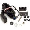
K10-00012-02 GMR 604 XHD Radar 4ft/6kW Pedestal Array
-
Package(E90W, GPS Antenna, DSM300G Sounder, 4KW 18 Inch Digital Radome & Radar Cable )
-
E92143 - 4KW 24 HD Digital Radome w/o Cable
-
NA-C603 Furuno FP Format Hawaiian Islands
-
Land navigation handbook: the Sierra Club guide to map, compass & GPS [Book]
-
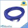
20ft 24AWG Cat5e 350MHz UTP Bare Copper Ethernet Network Cable - Purple
-
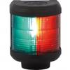
Navigation Light Bi Color
-
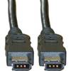
FireWire 6 Pin / 6 Pin 10ft Cable | IEEE-1394
-
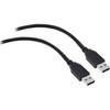
USB 3.0 Cable | Black | 6ft | Type A to Type A | Male/Male
-
HST-DFSBL TM 50/200 Depth and Temp Blue Connector
-
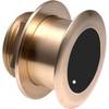
B175-20-M Broadband CHIRP, No CONNECTOR, Depth & Temperature Thru-Hull Tilted
-
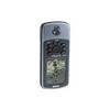
GPSMAP 76 - Marine, hiking GPS receiver - Monochrome - 240 x 180