8267; Map-Lake Oroville/San Luis
Model: 8267 Brand: Fish-n-Map
FISH-N-MAP UNDERWATER TOPOGRAPHY MAPSMade of waterproof, tear resistant plastic. Features include: underwater depth contours, fish locations, latitude and longitude for GPS, multiple freshwater lakes on one map, boat ramps, recreational facilities and much more.
Product Specification
-
Universal Product Identifiers
Part Numbers: 082671, 234800, 432450, 8267, MSI432450GTIN: 00761428082671
Related Products
-
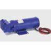
Constant Running Hydraulic Pump - Size 4 - 24V
-
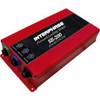
32610 SE-200C Sonar engine
-
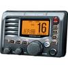
M504 Remote Mic Version - Black
-
2" Euro Black Series Fuel Level Gauge
-
4KW 48mi Open Array Antenna Complet
-
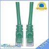
Cat6a Ethernet Cable | 2ft | Green | Network | 10 Gigabit
-
TM00701 Power Connector Plastic
-
1614g 38 100 Pcs Ring Heat Shrink Connector Blue
-
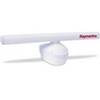
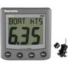
A22009-P ST60 Plus Speed w/Thru Hull Sensor
-
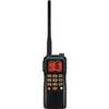
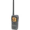
Submersible / Floating Handheld 6/5/2.5/1 W VHF Radio
-
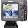
700 Series 798ci SI Combo NVB - Marine Chartplotter - 5" color - 640 x 640
-
Low2217 LHR-80 VHF GPS Handheld Marine Radio