A27 Imray Antigua Marine Nautical Chart
Model: A27 Brand: Weems And Plath
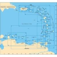
This Imray-Iolaire waterproof chart of Antigua Island includes large scale insets of Nonsuch Bay Mamora Bay Falmouth Bay and English Harbor. The chart is printed in color and uses official surveys and notes based on local knowledge. It is flat with no folds so is suitable for framing. Dimensions: 25 x 35 1/2 (640 x 900 cm). « less
Product Specification
-
Universal Product Identifiers
Part Number: A27
Related Products
-
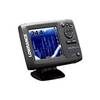
Elite 5x DSI - Fishfinder - included transducer : Skimmer DSI
-
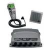
010-00757-00 VHF 300 AIS Marine Radio
-
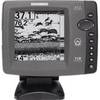
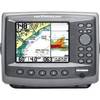
700 Series 718 - Fishfinder - included transducer : XNT-9-20-T - dual-beam
-
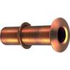
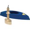
Thru Hull Connection, Extra Long, Bronze, Use with Pipe, 1-1/2"
-
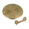
Screw in Deck Plates 5" Plate, Bronze
-
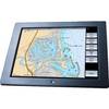
GB40 15 Inch Glass Bridge Navigation System (Requires GPS Antenna)
-
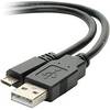
USB 2.0 A Male to Micro-B Male Cable 1.5 ft.
-
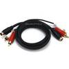
2187 3ft S-Video & 3ft RCA Audio Cable - Molded
-
B45-DT-HB 600W Thru-Hull Transducer Humminbird #9 Connector
-
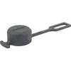
Weather cap - Cable end cap
-
Matrix 97 Sonar - Fishfinder - included transducer : XNT-9-20-T - dual-beam
-
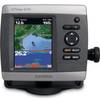
GPSMAP421S Color Combo SOUNDER/GPS w/TM Transducer