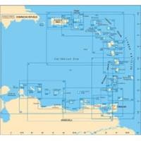
A28 Imray Guadeloupe Marine Nautical Chart
Model: A28 Brand: Weems And Plath
Francois and Marina de la Gde Saline Marine de Riviere Sens and Iles de la Petite Terre. The chart is flat with no folds so is suitable for framing. Size: 25 x 35-1/2 (640 x 900 cm).
Product Specification
-
Universal Product Identifiers
Part Number: A28
Related Products
-
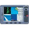
Colormax Pro 10.4" Chartplotter 29571
-
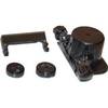
E25024 Console Mounting Bracket - ST40 INSTRUMENTS
-
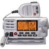
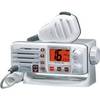
80dB Class D Fixed Mount VHF Radio Integrated AIS Receiver White
-
2680 Nauticast Class B AIS System W/ANTENNAS & Cables
-
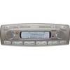
MR-18S Sirius-Ready AM/FM/CD Marine Stereo
-
1554 6ft Mini Optical Toslink M/M 5.0mm OD Molded Cable
-
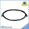
Mount 4079 1m RG58 W PL259 Connector
-
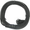
OPC-1000 20' Cable
-
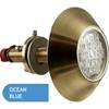
001-500067 2010 Thru Hull Underwater Light - Super Blue
-
Whisper Whi-500, 3 KW (24Mph Wind) Wind Turbine with Controller (48V)
-
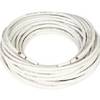
Cat6a Ethernet Cable | 1ft | Blue | Network | 10 Gigabit
-
Eclipse DSC GX1000 - VHF Marine Radio