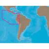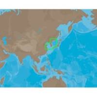
AN-M203 C-Card Format Yellow Sea & Malaya
Model: AN-M203 Brand: C-Map
Coverage of Yellow Sea to Malaya cover's Jiatiao Port - Xiangshan Harbour - Zhoushan City - Qantangjiang River Mouth - Zhoushan Archipelago - Yangtze River - Doulong Harbour Entrance - She-Yang River Mouth - Guan River Mouth - Lianyungang Port - Lanshan Harbour - Rizao Harbour - Quingao Port - Aoshan Port - Nudao Port - Entrance to Dingzi River - Jinghai Bay - Shidao Bay - Rongcheng Bay - Weihat Bay - Yantai Port - Penglari Port - Sanshan Head - Xiaoqinghe Mouth - Dongying Port - Tao Er River Entrance - Tianjing Port - Quinhuangdao Port - Pulanddian Bay - Dalian Bay - Changshan Archipelago - Shicheng Island - Dadong Port - Nampo Hang - Daesan Hang - Gyema Hang - Sinyang Port - T Aepaek - Zaliv Pos Yeta - Zaliv Nakhodka - Wakamatsu Island - Omura Wan - Matsuura Ko - Iki Island - Kita-kyushi - Seto Naikai - Komatsu and Toyama. « less
Product Specification
-
Universal Product Identifiers
Part Number: AN-M203C-CARDGTIN: 00686074013223
Related Products
-
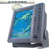
FR8252-6 Open Array Radar
-
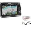
Package(e95 with USA Coastal Chart, 4KW 24 Inch Digital Radome & Radar Cable)
-
2.2KW 18 Radome 24 NM Range 5.2 Deg Beam 182x
-
Fishing Hot Spots E112 Pro USA Chart f/Lowrance
-
SA-C001 Furuno FP Format - Peru, P. Vallarta, P. Bolivar
-
010-C0773-20 Bluechart G2 HXEU015RAegean Sea & Sea of Marmara
-
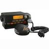
MRF55B VHF Radio Submersible Black
-
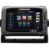
00010778001 HDS-7 Touch G2 Insight W-Lss
-
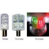
Navigation Light BAY15d Replacement Bulb 9353400
-
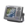
HDS-5m - Marine Chartplotter - 5" color - 480 x 480
-
E97 Multifunction Display w/Sonar - US Coastal Charts Map
-
VHF Handheld Radio Black (151-ICM88)