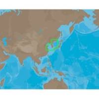
AN-M203 SD Card Format Yellow Sea & Malaya
Model: AN-M203 Brand: C-Map
Coverage of Yellow Sea to Malaya cover's Jiatiao Port - Xiangshan Harbour - Zhoushan City - Qantangjiang River Mouth - Zhoushan Archipelago - Yangtze River - Doulong Harbour Entrance - She-Yang River Mouth - Guan River Mouth - Lianyungang Port - Lanshan Harbour - Rizao Harbour - Quingao Port - Aoshan Port - Nudao Port - Entrance to Dingzi River - Jinghai Bay - Shidao Bay - Rongcheng Bay - Weihat Bay - Yantai Port - Penglari Port - Sanshan Head - Xiaoqinghe Mouth - Dongying Port - Tao Er River Entrance - Tianjing Port - Quinhuangdao Port - Pulanddian Bay - Dalian Bay - Changshan Archipelago - Shicheng Island - Dadong Port - Nampo Hang - Daesan Hang - Gyema Hang - Sinyang Port - T Aepaek - Zaliv Pos Yeta - Zaliv Nakhodka - Wakamatsu Island - Omura Wan - Matsuura Ko - Iki Island - Kita-kyushi - Seto Naikai - Komatsu and Toyama. « less
Product Specification
-
Universal Product Identifiers
Part Number: AN-M203SDCARD
Related Products
-
SP110RF-7 SP-110 System w/Rudder Feedback & Mechanical Remote D
-
E7 7" Multifunction Display Internal GPS Canadian T70004
-
FR8062 12.1 Inch 6KW, 72 nm, 12.1 Color Display Radar 4' Open Array Antenna fr80624
-
NA-C601 Acapulco, Mexico to Cape Flattery
-
408710-1 958c HD Di Combo
-
40400-7 S40 Masthead Navigation Light 12v/25w
-
Solara Marine Radio
-
Series 43 White LED Navigation Light Stern
-
10ft 24AWG Cat5e 350MHz UTP Bare Copper Ethernet Network Cable - Yellow
-
12ft VGA to 3 RCA Component Video Cable (HD15 - 3-rca)
-
PDRT-WBL Trolling Mnt w/Remote Temp Blue Connector
-
8075 1/4 Mc/Ma/Ya Fuel Connector