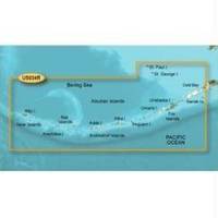
BlueChart g2 Vision - Aleutian Islands - Maps
Model: Brand: Garmin
BlueChart g2 Vision offers the same rich detailed charting of BlueChart g2 to help you get the most out of your unit. In addition, g2 Vision features a growing database of high-resolution satellite imagery, above and below the water 3D perspective, auto guidance technology, aerial photographs for real world reference and coastal roads with points of interest. This product features coverage of the Aleutian Islands from Attu Island to Cold Bay, including Adak Station and Unalaska. Also covers the Pribilof Islands, including St. Paul Island and St. George Island. « less
Product Specification
-
General
Product Type: MapsDistribution Media: SD Memory CardFirst Seen On Google Shopping: June 2007 -
Compatibility Information
Designed For: Garmin GPSMAP 4008, 4012, 420, 4208, 420s, 4212, 430, 430s, 430sx, 430x, 440, 440s, 440sx, 440x, 450, 5008, 5012, 520, 5208, 520s, 5212, 525, 525s, 530, 530s, 535, 535s, 540, 540s, 545, 545s, 550, 550s, 555, 555s -
Universal Product Identifiers
Part Numbers: 010-C0735-00, Aleutian Islands
Related Products
-
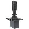
E12136 Autopilot Joy Stick
-
hi731340 200 L Graduated Pipette
-
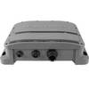
E102143 CP450C ClearPulse Chirp Sonar
-
T62291 C Series Widescreen System Packs
-
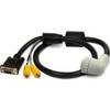
010-11091-00 Marine Audio/Video Cable, Right Angle
-
The Nautical Chart - 11 x 17 Movie Poster - Spanish Style A
-
Bronze Seacock, 1 Inch Adapter, 90 Degree 0834006PLB
-
432-0004-03-00S First Mate Handheld Thermal Imager
-
Base Mount All Round Navigation Lights Light, Green
-
1ft 18AWG Power Cord Cable w/ 3 Conductor PC Power Connector Socket (C13/5-15P) - Black
-
SP-BL TM Speed Sensor Blue Connector LOWSPBL
-
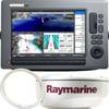
900 Series 917c Combo - Marine Chartplotter - 7" color - 800 x 480 - widescreen