BlueChart g2 Vision - Hecate Strait South - Maps
Model: Brand: Garmin
BlueChart g2 Vision offers the same rich detailed charting of BlueChart g2 to help you get the most out of your unit. In addition, g2 Vision features a growing database of high-resolution satellite imagery, above and below the water 3D perspective, auto guidance technology, aerial photographs for real world reference and coastal roads with points of interest. This product features coverage of the southern portion of the Queen Charlotte Islands, Hecate Strait, Queen Charlotte Sound, and Queen Charlotte Strait. Includes detailed coverage of many areas including Port Hardy, BC, Burke Channel and Dean Channel. « less
Product Specification
-
General
Product Type: MapsDistribution Media: SD Memory CardFirst Seen On Google Shopping: May 2007 -
Compatibility Information
Designed For: Garmin GPSMAP 4008, 4012, 420, 4208, 420s, 4212, 430, 430s, 430sx, 430x, 440, 440s, 440sx, 440x, 450, 5008, 5012, 520, 5208, 520s, 5212, 525, 525s, 530, 530s, 535, 535s, 540, 540s, 545, 545s, 550, 550s, 555, 555s -
Universal Product Identifiers
Part Numbers: 010-C0695-00, Hecate Strait SouthGTIN: 00753759068752
Related Products
-
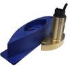
Radar Mount, Edson Basic Fixed Flybridge Tower System for 8 to 16 Mile Radars
-
49650200stes Bth Tri 500W for ES502
-
T70044 E95 Multifunction Display w/ROW Charts
-
Hydrographical Surveying: A Description of the Means and Methods Employed in Construcing Marine Charts [Book]
-
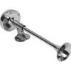
Afi -10010 Compact Single Trumpet Horn SS
-
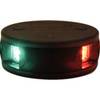
LED Bicolor Light Black 12V
-
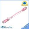
0.5ft 24AWG Cat5e 350MHz UTP Bare Copper Ethernet Network Cable - Pink
-
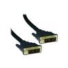
3.3 ft DVI cable - single link 18 pin digital DVI (Single-Link) - male - PC
-
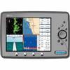
Marine EC11 GPS-Chartplotter/Fish Finder with External Antenna, C-Map Max Card & 10.4" Color Display; NMEA Network Compatible - SI-TEX
-
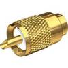
PL-259-8X-G Gold Solder-Type Connector
-
Terminal, Feed Thru 3/8 Small Red
-
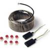
010-10742-00 Control Area Network (Can) Kit