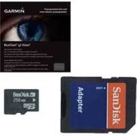
BlueChart g2 Vision - Irish Sea - Maps
Model: Brand: Garmin
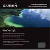
Plug a BlueChart g2 Vision SD data card into your chartplotter, and you'll get a whole new perspective on nautical navigation. BlueChart g2 Vision offers the same rich detailed charting of BlueChart g2 to help you get the most out of your unit. In addition, g2 Vision features a growing database of high-resolution satellite imagery, above and below the water 3D perspective, auto guidance technology, aerial photographs for real world reference and coastal roads with points of interest. British coast: covers from Port Ellen on the Isle of Islay to Falmouth, including the Isle of Man and the Isles of Scilly. Irish coast: covers from Sheep Haven to Caherciveen, Republic of Ireland, including Londonderry, The Storks, Belfast, and Dublin. « less
Product Specification
-
General
Product Type: MapsDistribution Media: SD Memory CardFirst Seen On Google Shopping: June 2007 -
Compatibility Information
Designed For: Garmin GPSMAP 4008, 4012, 420, 4208, 420s, 4212, 430, 430s, 430sx, 430x, 440, 440s, 440sx, 440x, 450, 5008, 5012, 520, 5208, 520s, 5212, 525, 525s, 530, 530s, 535, 535s, 540, 540s, 545, 545s, 550, 550s, 555, 555s -
Universal Product Identifiers
Part Numbers: 010-C0763-00, Irish SeaGTIN: 00159165739789, 00753759069438
Related Products
-
Package(C140W, RA1072HD 4KW 72 Inch HD Digital Open Array Radar & 15m Radar Cable)
-
GX5500S Two-Way Radio,marine,25 Watts 4lpt6
-
BlueChart g2 Vision - Lake Michigan - Maps
-
010-C0732-20 Bluechart G2 HXUS031RSouthwest Caribbean microSD
-
GX2100SB Two-Way Radio, Marine, 25 Watts
-
3520-7 LED Red Green, Deck Mount Navigation Light
-
6ft 28AWG High Speed HDMI Cable w/Ferrite cores - Blue
-
LS4100/TM
-
100HF1 120/250VAC - 100 Amp Female Connector
-
1852069 Adapter Cable Lowrance 6 Pin
-
Southwest Wind Power 48 Volt Air Breeze Marine Turbine
-
eTrex Vista HCx - Hiking GPS receiver - Color - 176 x 220