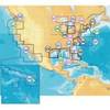
BlueChart g2 Vision - Italy, Adriatic Sea - Maps
Model: Brand: Garmin
BlueChart g2 Vision offers the same rich detailed charting of BlueChart g2 to help you get the most out of your unit. In addition, g2 Vision features a growing database of high-resolution satellite imagery, above and below the water 3D perspective, auto guidance technology, aerial photographs for real world reference and coastal roads with points of interest. This product features coverage of all of the Adriatic Sea and extends south to Siracusa, Sicilia and Gulf of Arcadia, Greece. Includes detailed coverage of Lago Maggiore, Lago d'Iseo, and Lago d'Garda in Italy. « less
Product Specification
-
General
Product Type: MapsDistribution Media: SD Memory CardFirst Seen On Google Shopping: June 2007 -
Universal Product Identifiers
Part Numbers: 010-C0772-00, Italy, Adriatic SeaGTIN: 00753759069520 -
Compatibility Information
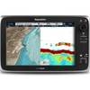
Designed For: Garmin GPSMAP 4008, 4012, 420, 4208, 420s, 4212, 430, 430s, 430sx, 430x, 440, 440s, 440sx, 440x, 450, 5008, 5012, 520, 5208, 520s, 5212, 525, 525s, 530, 530s, 535, 535s, 540, 540s, 545, 545s, 550, 550s, 555, 555s
Related Products
-
MSD/645P+ Platinum Plus North Carolina on SD/MicroSD
-
CF/643P+ Platinum Plus Oregon and California on CF
-
Marine World Chart of Nicolo de Canerio Januensis, Circa 1502: A Critical Study (1908) [Book]
-
T70032 C125 Multifuntion Display w/European Charts
-
Canadian Charts Strait of Georgia-Central Part
-
3995.4 Firefly 3 Strobe Same as 3995.3 But Bulk PK
-
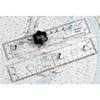
90 Marine Navigation ParaLock Plotter
-
6ft 30AWG High Speed HDMI Cable - HDMI Connector to HDMI Mini Connector - Black
-
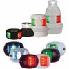
Series 32 LED Navigation Lights White Housing
-
10ft Premium Optical Toslink Cable w/ Metal Fancy Connector
-
Serial extension cable - (DB-9) - F - (DB-9) - M - 10 ft - PC
-
E62186-IN - A50D 5 Combo, Inland Maps, Int GPS