BlueChart g2 Vision - Lake Michigan - Maps
Model: Brand: Garmin
BlueChart g2 Vision offers the same rich detailed charting of BlueChart g2 to help you get the most out of your unit. In addition, g2 Vision features a growing database of high-resolution satellite imagery, above and below the water 3D perspective, auto guidance technology, aerial photographs for real world reference and coastal roads with points of interest. This product features detailed coverage of Lake Michigan in its entirety and northern Lake Huron from Cheboygan, MI, to Blind River, Ont., including Sault Ste. Marie and Cockburn Island. « less
Product Specification
-
General
Product Type: MapsDistribution Media: SD Memory CardFirst Seen On Google Shopping: May 2007 -
Compatibility Information
Designed For: Garmin GPSMAP 4008, 4012, 420, 4208, 420s, 4212, 430, 430s, 430sx, 430x, 440, 440s, 440sx, 440x, 450, 5008, 5012, 520, 5208, 520s, 5212, 525, 525s, 530, 530s, 535, 535s, 540, 540s, 545, 545s, 550, 550s, 555, 555s -
Universal Product Identifiers
Part Numbers: 010-C0717-00, Lake MichiganGTIN: 00753759068974
Related Products
-
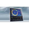
CH270/324 180 kHz Searchlight Sonar System with 10.4 Inch Color LCD Display. Includes 350mm Travel Hoist and Operates at 24 and 32VDC
-
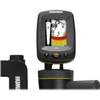
Fishin' Buddy 140c - Fishfinder - portable - included transducer - single-beam
-
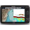
T70034 C125 Multifunction Display w/ROW Charts
-
000-10345-001 - NSE12 Navigation Pack
-
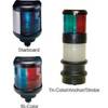
40 Tricolor/Anchor Nav Lite 12/25w
-
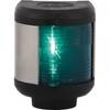
Navigation Light Starboard
-
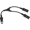
M101RYC-RET Y Cable for Marine Receivers for Dual Remotes
-
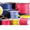
10/3 30 Amp Cable, 250' Spool, Yellow 14179
-
3ft 28AWG DisplayPort Cable - White
-
HS-WSBL Transom Mount Transducer Blue Connector whswsbl
-
InterLink - Fishfinder InterLink system connection module
-
Cat6a Ethernet Cable | 7ft | Gray | Network | 10 Gigabit