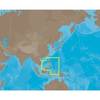
BlueChart g2 Vision - Lake Superior - Maps
Model: Brand: Garmin
BlueChart g2 Vision offers the same rich detailed charting of BlueChart g2 to help you get the most out of your unit. In addition, g2 Vision features a growing database of high-resolution satellite imagery, above and below the water 3D perspective, auto guidance technology, aerial photographs for real world reference and coastal roads with points of interest. This product features detailed Lake Superior and northern Lake Huron are covered in detail for the U.S. portion from Duluth through Alpena, including Crooked Lake, Burt Lake, and Mullett Lake in Michigan; and for the Canadian portion from Thunder Bay to Tobermory, Ont. « less
Product Specification
-
General
Product Type: MapsDistribution Media: SD Memory CardFirst Seen On Google Shopping: May 2007 -
Compatibility Information
Designed For: Garmin GPSMAP 4008, 4012, 420, 4208, 420s, 4212, 430, 430s, 430sx, 430x, 440, 440s, 440sx, 440x, 450, 5008, 5012, 520, 5208, 520s, 5212, 525, 525s, 530, 530s, 535, 535s, 540, 540s, 545, 545s, 550, 550s, 555, 555s -
Universal Product Identifiers
Part Numbers: 010-C0716-00, Lake SuperiorGTIN: 00753759068967
Related Products
-
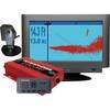
37593 Escort Sonar Module with Transom Mount, Keypad, Vide
-
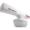
4KW 48" HD Digital Open Array Radar
-
Marine ILIM40501 Sydney LED Reading Chart Marine Light
-
AS-M205 C-Card Format Philippines
-
Max EN-M082 W28 River Danube-MAX
-
Canadian Charts - A, Alberni inlet/pt alberni/robbers Pa Canadian
-
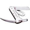
1551 Rigging Knife Deluxe
-
Cat6a Ethernet Cable | 2ft | Green | Network | 10 Gigabit
-
10ft 24AWG Cat6 550mhz UTP Ethernet Bare Copper Network Cable - White
-
18inch SATA Data and Power Combo Cable - Dark Grey
-
Wiring Device-Kellems HBL61CM64 Inlet,marine,15 A 3d235
-
9282.3 PT Pad Remote Kit for RCL50-100