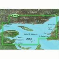
BlueChart g2 Vision - Les Mechins to St. George's Bay - Maps
Model: Brand: Garmin
BlueChart g2 Vision offers the same rich detailed charting of BlueChart g2 to help you get the most out of your unit. In addition, g2 Vision features a growing database of high-resolution satellite imagery, above and below the water 3D perspective, auto guidance technology, aerial photographs for real world reference and coastal roads with points of interest. This product features coverage of the coasts of New Brunswick and Quebec from Miramichi Bay to Les Mechins, Que., including Chaleur Bay and the Bay of Gaspe. Also covers the coast of Quebec to the north from Port-Cartier to St.-Augustin, including Sept-Iles and Havre-St.-Pierre. Also includes Ile d'Anticosti and the St. George's Bay area of New Foundland. « less
Product Specification
-
General
Product Type: MapsDistribution Media: SD Memory CardFirst Seen On Google Shopping: May 2007 -
Universal Product Identifiers
Part Numbers: 010-C0693-00, Les Mechins to St. George's BayGTIN: 00753759068738 -
Compatibility Information
Designed For: Garmin GPSMAP 4008, 4012, 420, 4208, 420s, 4212, 430, 430s, 430sx, 430x, 440, 440s, 440sx, 440x, 450, 5008, 5012, 520, 5208, 520s, 5212, 525, 525s, 530, 530s, 535, 535s, 540, 540s, 545, 545s, 550, 550s, 555, 555s
Related Products
-
Land navigation handbook: the Sierra Club guide to map, compass & GPS [Book]
-
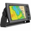
NavNet 3D Color 8.4" LCD Multifunction Display
-
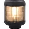
Navigation Light Stern
-
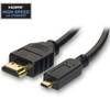
HDMI to Micro HDMI Cable, High Speed with Ethernet, 10 ft
-
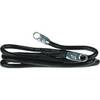
4-Gauge Switch-to-Starter 24 Battery Cable
-
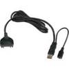
USB cable - 4 pin USB Type A - M - PC
-
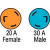
F3020ADSS Adapter,30A M to 20A F
-
E97 Multifunction Display w/Sonar - US Coastal Charts Map
-
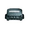
InterLink - Fishfinder InterLink system connection module
-
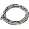
7ft 24AWG Cat6 500mhz Crossover Ethernet Bare Copper Network Cable - Gray
-
300 Series 383c Combo - Marine Chartplotter - 3" color - 240 x 320
-
AIS Network Dual Channel Rcvr w/GPS