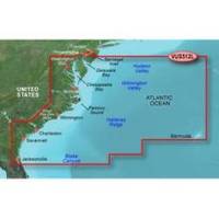
BlueChart g2 Vision - Mid-Atlantic - Maps
Model: Brand: Garmin
BlueChart g2 Vision offers the same rich detailed charting of BlueChart g2 to help you get the most out of your unit. In addition, g2 Vision features a growing database of high-resolution satellite imagery, above and below the water 3D perspective, auto guidance technology, aerial photographs for real world reference and coastal roads with points of interest. This product features coverage of the East Coast from the lower Chesapeake Bay through Jacksonville, FL, to Bermuda. Coverage from Tangier Island to St. Augustine, FL including Norfolk, VA, the Albemarle and Pamlico Sounds in full, Cape Fear, NC, the Savannah R. to Augusta, GA, and the St. Johns R. to Hastings, FL. Bathymetric coverage from Poorman's Canyon to Blake Canyon including Wilmington Valley and Hatteras Ridge. « less
Product Specification
-
General
Product Type: MapsDistribution Media: SD Memory CardFirst Seen On Google Shopping: May 2007 -
Compatibility Information
Designed For: Garmin GPSMAP 4008, 4012, 420, 4208, 420s, 4212, 430, 430s, 430sx, 430x, 440, 440s, 440sx, 440x, 450, 5008, 5012, 520, 5208, 520s, 5212, 525, 525s, 530, 530s, 535, 535s, 540, 540s, 545, 545s, 550, 550s, 555, 555s -
Universal Product Identifiers
Part Numbers: 010-C0741-00, Mid-AtlanticGTIN: 00753759069216, 00828160839472
Related Products
-
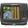
HDS-7 Gen2 Fishfinder GPS Chartplotter 53518700
-
6865 Vision Series Light Arm
-
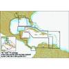
Bahamas: NT+ Wide Coverage by C-Map
-
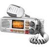
Solara D UM380 Fixed Mount Class D VHF Marine Radio
-
Chart No. 1 Nautical Chart Symbols Abbreviations and Terms [Book]
-
Children's Life Jacket PFD 2
-
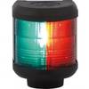
Navigation Light Bi Color
-
41320-1 S41 Port Navigation Light 24V, Black
-
75ft 24AWG Cat5e 350MHz UTP Bare Copper Ethernet Network Cable - Purple
-
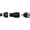
010-11095-00 NMEA 2K Female Connector
-
lian B3-I2DN I2 System Dish Network All-in-One Package w/Multi-Sa
-
GM1600 VHF Radio GMDSS W/DATED/SEALED Lithium Battery