BlueChart g2 Vision - Mobile to Lake Charles - Maps
Model: Brand: Garmin
BlueChart g2 Vision offers the same rich detailed charting of BlueChart g2 to help you get the most out of your unit. In addition, g2 Vision features a growing database of high-resolution satellite imagery, above and below the water 3D perspective, auto guidance technology, aerial photographs for real world reference and coastal roads with points of interest. This product features Mobile, AL through Calcasieu Lake, LA, including New Orleans, the Mississippi River Delta, Lake Ponchartrain and Lake Maurepas, over to Vermilion Bay. « less
Product Specification
-
General
Product Type: MapsDistribution Media: SD Memory CardFirst Seen On Google Shopping: May 2007 -
Compatibility Information
Designed For: Garmin GPSMAP 4008, 4012, 420, 4208, 420s, 4212, 430, 430s, 430sx, 430x, 440, 440s, 440sx, 440x, 450, 5008, 5012, 520, 5208, 520s, 5212, 525, 525s, 530, 530s, 535, 535s, 540, 540s, 545, 545s, 550, 550s, 555, 555s -
Universal Product Identifiers
Part Numbers: 010-C0714-00, Mobile to Lake CharlesGTIN: 00753759068943
Related Products
-
GTX AIS Class B AIS Transceiver 16 Channel GPS
-
2-018 Outdoor US Midwest Chart for Endura Series
-
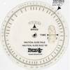
105 Marine Navigation Nautical Slide Rule
-
Western U.S. Fishing Maps Sea of Cortez North Chart
-
Innovative Lighting Portable Bow Light 560-1601-7
-
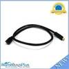
3ft 24AWG CL2 High Speed HDMI Cable Male to Female Extension - Black
-
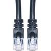
Cat6a Ethernet Cable | 35ft | Black | Network | 10 Gigabit
-
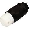
F50Fmp-Ss 50A 125V Connector (F)
-
MHS75 VHF Two-way radio
-
3ft 24AWG Cat6 550mhz UTP Ethernet Bare Copper Network Cable - Blue
-
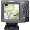
GPSMAP 740 - Marine Chartplotter - 7" color - 800 x 480 - widescreen
-
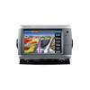
700 Series 788c Combo - Marine Chartplotter - 5" color - 640 x 640