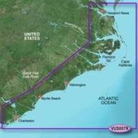
BlueChart g2 Vision - Norfolk-Charleston - Maps
Model: Brand: Garmin
BlueChart g2 Vision offers the same rich detailed charting of BlueChart g2 to help you get the most out of your unit. In addition, g2 Vision features a growing database of high-resolution satellite imagery, above and below the water 3D perspective, auto guidance technology, aerial photographs for real world reference and coastal roads with points of interest. This product features Newport News, VA to Charleston, SC including Pamlico Sound, Cape Lookout, and Cape Romain. « less
Product Specification
-
General
Product Type: MapsDistribution Media: SD Memory CardFirst Seen On Google Shopping: May 2007 -
Compatibility Information
Designed For: Garmin GPSMAP 4008, 4012, 420, 4208, 420s, 4212, 430, 430s, 430sx, 430x, 440, 440s, 440sx, 440x, 450, 5008, 5012, 520, 5208, 520s, 5212, 525, 525s, 530, 530s, 535, 535s, 540, 540s, 545, 545s, 550, 550s, 555, 555s -
Universal Product Identifiers
Part Numbers: 010-C0708-00, Norfolk-CharlestonGTIN: 00753759068882
Related Products
-
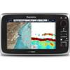
C97 Multifunction 9" Display with Sonar - US Coastal Charts T70021 c44326
-
Radar 5212 Package with GMR18 4KW Radome
-
31XG/CF Indian Ocean and South China Sea Gold
-
SA-C003 C-Card Format - Rio de Janeiro - Cape Horn
-
T70044 E95 Multifunction Display w/ROW Charts
-
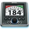
GSC Autopilot No Rudder Feed Back or Drive 700048-1
-
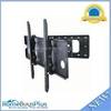
Adjustable Tilting/Swiveling Wall Mount Bracket for LCD LED Plasma - Corner Friendly (Max 125Lbs, 32~60inch) (REV.2.0)
-
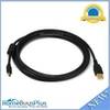
6ft USB 2.0 A Male to Mini-B 5pin Male 28/24AWG Cable w/ Ferrite Core (Gold Plated)
-
USB to Parallel(DB25 Female) Converter Cable - 4ft (DB25)
-
Marine -3899-3 St CONNECTOR-THREAD to 3/4 Barb
-
8.0 Beg Generator
-
CRC Marine Electronics Die-Lectic Grease 06106 (3.3 oz.)