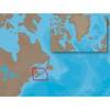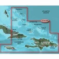
BlueChart g2 Vision - Southern Bahamas - Maps
Model: Brand: Garmin
BlueChart g2 Vision offers the same rich detailed charting of BlueChart g2 to help you get the most out of your unit. In addition, g2 Vision features a growing database of high-resolution satellite imagery, above and below the water 3D perspective, auto guidance technology, aerial photographs for real world reference and coastal roads with points of interest. This product features data from explorer charts for the Bahamas! Detailed coverage from Eleuthera Island, Bahamas to the Dominican Republic, including the Bahamian islands of Great Exuma, Great Inagua, Mayaguana, and many others. Also includes detailed coverage of the Jamaican, Haitian, and Dominican coasts in their entirety, the easternmost quarter of Cuba, and the Turks and Caicos Islands. « less
Product Specification
-
General
Product Type: MapsDistribution Media: SD Memory CardFirst Seen On Google Shopping: May 2007 -
Compatibility Information
Designed For: Garmin GPSMAP 4008, 4012, 420, 4208, 420s, 4212, 430, 430s, 430sx, 430x, 440, 440s, 440sx, 440x, 450, 5008, 5012, 520, 5208, 520s, 5212, 525, 525s, 530, 530s, 535, 535s, 540, 540s, 545, 545s, 550, 550s, 555, 555s -
Universal Product Identifiers
Part Numbers: 010-C0730-00, Southern BahamasGTIN: 00753759069100
Related Products
-
International Radar Mounting Platform Small 975-1111
-
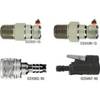
NA-C205 C-Card Format - Fundy Nova Scotia Pei Cape Br
-
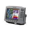
EC5I 5 Inch Color Plotter with Internal GPS
-
Marine World Chart of Nicolo De Canerio Januensis 1502: A Critical Study [Book]
-
FBRS 2744 Battery Service Include 1098.1 Bat Parts Labor
-
176 Marine Navigation Ultralight Divider
-
SP36-5 Autopilot w/ Rate Comp Rotary Feedback 18CI Pump
-
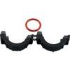
010-11170-02 - Split Collar w/ 14.5mm Connector
-
83A 30A Locking to 15A Straight Blade Adapter
-
3349810; Tank Fitting Honda 3/8 Inch Female 1991+
-
(1) 100 Amp 125/250 Volt Connector to (2) 50 Amp
-
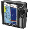
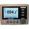
HDS-8 - Marine Chartplotter - 8" color - 800 x 600