BlueChart g2 Vision - Tampa to New Orleans - Maps
Model: Brand: Garmin
BlueChart g2 Vision offers the same rich detailed charting of BlueChart g2 to help you get the most out of your unit. In addition, g2 Vision features a growing database of high-resolution satellite imagery, above and below the water 3D perspective, auto guidance technology, aerial photographs for real world reference and coastal roads with points of interest. This product features bradenton, FL through New Orleans, LA including Apalachicola, Mobile, the Mississippi Delta, Chandeleur Islands, and a portion of Timbalier Bay. Also covers Lake Ponchartrain. « less
Product Specification
-
General
Product Type: MapsDistribution Media: SD Memory CardFirst Seen On Google Shopping: May 2007 -
Compatibility Information
Designed For: Garmin GPSMAP 4008, 4012, 420, 4208, 420s, 4212, 430, 430s, 430sx, 430x, 440, 440s, 440sx, 440x, 450, 5008, 5012, 520, 5208, 520s, 5212, 525, 525s, 530, 530s, 535, 535s, 540, 540s, 545, 545s, 550, 550s, 555, 555s -
Universal Product Identifiers
Part Numbers: 010-C0713-00, Tampa to New OrleansGTIN: 00753759068936
Related Products
-
AC70 Autopilot Computer 000-10186-001
-
SP110VF-5 SP-110 System w/Virtual Feedback & Mechanical Drive U
-
Package(C120W, DSM300G Sounder, 4KW 18 Inch Digital Radome & Radar Cable)
-
Max AN-M204 W52 Japan and Hokkaido-MAX
-
04-4006-000 Power I/O Cable f/Chart Master 11 & V6 Series
-
E25024 Console Mounting Bracket - ST40 INSTRUMENTS
-
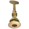
0363DP0PLB Plug Garboard Drain 3/4in
-
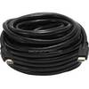
2110 50ft 24AWG CL2 Standard HDMI Cable - Black
-
FA58976-1 - Connector assy , NLA Mercury Marine
-
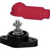
2003 3/8 in. Power Post
-
CA50/200 12M HIGH-PERFORMANCE Bronze Thru-Hull Transducer
-
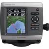
GPSMAP 421s GPS Dual Frequency Combo