BlueChart g2 Vision - Wrangell / Juneau / Sitka - Maps
Model: Brand: Garmin
BlueChart g2 Vision offers the same rich detailed charting of BlueChart g2 to help you get the most out of your unit. In addition, g2 Vision features a growing database of high-resolution satellite imagery, above and below the water 3D perspective, auto guidance technology, aerial photographs for real world reference and coastal roads with points of interest. This product features detailed coverage from Wrangell to Glacier Bay, Sitka and Juneau. « less
Product Specification
-
General
Product Type: MapsDistribution Media: SD Memory CardFirst Seen On Google Shopping: May 2007 -
Compatibility Information
Designed For: Garmin GPSMAP 4008, 4012, 420, 4208, 420s, 4212, 430, 430s, 430sx, 430x, 440, 440s, 440sx, 440x, 450, 5008, 5012, 520, 5208, 520s, 5212, 525, 525s, 530, 530s, 535, 535s, 540, 540s, 545, 545s, 550, 550s, 555, 555s -
Universal Product Identifiers
Part Numbers: 010-C0727-00, Wrangell / Juneau / SitkaGTIN: 00753759069070, 00790374408532
Related Products
-
Chartmaster V6I U1-CHRT-V6I 15891
-
Max Lakes West NA-M020 c30551
-
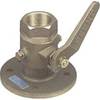
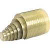
1" Seacock Body
-
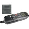
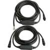
E42001 RAY240 VHF
-
0805005PLB 3/4" Seacock Ball Valve Bronze
-
3820ST1 Light,Nav(Sold Pair Only)12Vss
-
Deck Plates, Fills for Pipe, 3", Unmarked, Bronze
-
6ft 24AWG CL2 High Speed HDMI to DVI Adapter Cable W / Net Jacket - Black
-
1.5ft Premium 2 RCA Plug/2 RCA Plug M/M 22AWG Cable - Black
-
Trident Marine Hose 5" x 6" Fiberglass Splicer
-
010-11324-00 - Gra 10 Rudder Angle Adpt
-
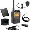
Mr HH 425LI VP Marine Handheld VHF/GMRS Radio w/ Rewind-Say-Again COB-MRHH425LIVP