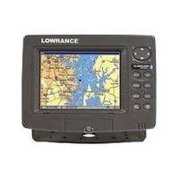
GlobalMap 7200C - Marine GPS receiver - 7" color - 640 x 480
Model: 7200C Brand: Lowrance
A 7" display, networking and GPS chartplotter performance features, including a newly-expanded built-in background map of the continental U.S. and Hawaii with over 3,000 lakes with depth contours. Also features Lowrance radar compatibility!
Product Specification
-
General
Product Type: GPS receiverRecommended Use: MarinePreloaded Maps: USA, HawaiiReceiver: 12 channelCard Reader: SD Memory CardInterface: Serial, NMEA 0183, NMEA 2000Functions & Services: MOB (Man Overboard)Compatible Software: Lowrance NauticPath USA Marine Electronic Charts, Lowrance Fishing Hot Spots Elite, Lowrance FreedomMaps USA Topo, Lowrance LakeMaster Pro Maps, Lowrance MapCreate USA Topo, Navionics chartsSBAS: WAASAntenna: ExternalFeatures: Backlit keypadFirst Seen On Google Shopping: August 2007 -
Display
Type: TFT - colorDiagonal Size: 7"Resolution: 640 x 480Display Illumination: Yes -
Navigation
Waypoints: 1000Tracks: 100Routes: 100 -
Connections
Interfaces: Serial Ethernet -
Miscellaneous
Protection: Waterproof -
Dimensions & Weight
Width: 9.3 inDepth: 3.7 inHeight: 6.8 in -
Manufacturer Warranty
Service & Support: 1 year warranty -
Universal Product Identifiers
Part Numbers: 123-22, 7200CGTIN: 00042194529394
Related Products
-
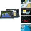
G10 10" Mfd W/2KW Sonar 408020-1
-
BlueChart g2 Vision - Adriatic Sea, North Coast - Maps
-
LED Stern Transom Mount Black ASL-335027
-
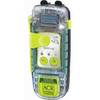
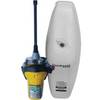
2885 SARLink View GPS PLB
-
Cat6a Ethernet Cable | 3ft | Black | Network | 10 Gigabit
-
USB 3.0 Micro Cable | 10ft | Type A | Micro Type B | Black
-
Whisper 36 Inch Galvanized Augers Set of Four Earth Anchors
-
123A Adapter 50A/125V - 50a/250v
-
FCF-5000 Feel Cool Fast Marine Air Conditioner by Webasto
-
GX1500SW 25W Fixed Mount VHF Second Sta
-
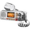
UM380 White VHF Radio Class D UM480
-
Auto EPIRB Non-GPS Cat 1 K82-804-004a