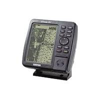
GPSMAP 182 - Marine GPS receiver - 5.5" monochrome - 360 x 240
Model: 182 Brand: Garmin
The GPSMAP 182 Series features crisp, high-resolution display and high-speed processor, which allow for an extremely fast redraw rate. This chartplotter has a built-in WAAS receiver, which means it can pinpoint your location and other map features within three meters, on average. The GPSMAP 182 Series' built-in worldwide basemap provides coastline detail, U.S. tide data, and inland cartography. The detail gets even better when you plug in an optional data card with Garmin's exclusive BlueChart marine cartography or detailed maps from Garmin's MapSource product line. Like all Garmin marine products, this unit is tough enough to stand up to saltwater, sunlight, and other elements. « less
Product Specification
-
General
Product Type: GPS receiverRecommended Use: MarineReceiver: 12 channelInterface: Serial, NMEA 0183, RTCM SC-104 DGPSFunctions & Services: Tide Tab, MOB (Man Overboard)Included Software: Garmin Worldwide Marine BasemapCompatible Software: MapSource BlueChartGrids: UTM, MGRS, Lat/Lon, UPS, Loran TDs, MaidenheadSBAS: WAASDGPS: DGPS readyAntenna: Built-inUpdate Rate: 1/secondFirst Seen On Google Shopping: December 2005Accuracy: Position - 49 ft Velocity - 0.16 ft/sec Position - 10 ft - 16 ft ( with DGPS ) Position - 10 ft ( with WAAS ) -
Display
Type: LCD - monochromeDiagonal Size: 5.5"Resolution: 360 x 240Display Illumination: Yes -
Acquisition Times
Warm: 15 secCold: 45 sec -
Navigation
Waypoints: 3000Tracks: 15Tracklog Points: 2500Routes: 50Waypoints per route: 50Trip Computer: TracBack, average speed, maximum speed, trip timer, trip distance -
Connections
Interfaces: Antenna Serial -
Miscellaneous
Protection: WaterproofWaterproof Standard: IPX7Included Accessories: Protective cover, mounting bracket -
Dimensions & Weight
Width: 6.3 inDepth: 2.6 inHeight: 6.2 inWeight: 27.2 oz -
Environmental Parameters
Min Operating Temperature: 5 °FMax Operating Temperature: 158 °F -
Universal Product Identifiers
Part Numbers: 010-00238-00, 010-00238-01, 182GTIN: 00753759028107
Related Products
-
Mini RE-1 Radar engine 2KW 24km 11" 41405
-
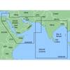
MapSource BlueChart - The Gulf and Red Sea - Maps
-
BlueChart g2 Vision - North Slope Alaska - Maps
-
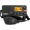
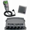
000-10788-001 Link-5 DSC VHF Radio
-
Cat6a Ethernet Cable | 5ft | Orange | Network | 10 Gigabit
-
AP2401VRF Autopilot AP24,AC12,RC42 No Drive Unit
-
Navigation Light BAY15d Replacement Bulb 9353384
-
14ft 24AWG Cat6 550mhz UTP Ethernet Bare Copper Network Cable - Blue
-
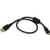
1.5ft USB 2.0 A Male to Mini-B 4pin Male 28/24AWG Cable w/ Ferrite Core (Gold Plated)
-
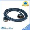
343 10ft HD60M/V.35M Cable (CAB-V35MT-3M)
-
Connector Kit for 3/8 Inch LED Rope Light - Imt-ilmdl-conkit-l6
-
010-00757-01 VHF 300i AIS Marine Radio