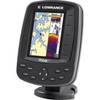
GPSMAP 521s - Marine Chartplotter - 5" color - 234 x 320
Model: 521s Brand: Garmin
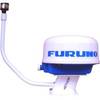
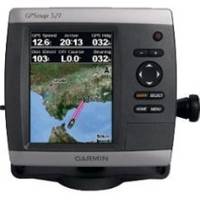
The GPSMAP 521 is a compact chartplotter that features an ultra-bright 5" QVGA color display along with an improved high-speed digital design for increased map drawing and panning speeds. It's ready to go with a built-in, satellite-enhanced worldwide basemap and an easy-to-use interface designed to help you navigate the open waters with ease. Where applicable, the sounder version, GPSMAP 521s, comes with a powerful dual-frequency transducer that clearly illustrates depth contours, fish targets and structures whether you're fishing in fresh water or off the coast. The GPSMAP 521s is also NMEA 2000-certified for easy connectivity with sensors, instruments and future marine offerings. « less
Product Specification
-
General
Product Type: ChartplotterRecommended Use: MarineCard Reader: SD Memory CardInterface: NMEA 0183, NMEA 2000Included Software: Garmin Worldwide Marine BasemapCompatible Software: BlueChart g2 VisionAntenna: Built-inFeatures: Optional external GPS antenna connection, alarm, automatic routingFirst Seen On Google Shopping: November 2009 -
Display
Type: LCD - colorDiagonal Size: 5"Resolution: 234 x 320Features: Adjustable brightness -
Transducer
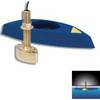
Transducer Presence: Included transducerTransducer Type: Dual-beam -
Navigation
Waypoints: 3000Tracks: 50Tracklog Points: 10000Routes: 100Trip Computer: Sun/moon positions -
Miscellaneous
Body Material: High-impact plasticProtection: WaterproofWaterproof Standard: IPX7Included Accessories: Protective cover, power/data cable, flush mount -
Dimensions & Weight
Width: 5.9 inDepth: 2.9 inHeight: 6.4 inWeight: 1.8 lbs -
Universal Product Identifiers
Part Numbers: 010-00760-01, 010-00760-02, 521sGTIN: 00753759095994
Related Products
-
Admiral Color Display with SSRC1 Rate Gyro Compass & Rotary Feedback 10110037
-
116-05 M68C S/Map - No Transducer 116-052
-
CH270BB/212 180 kHz Black Box Searchlight Sonar System. Includes 250mm Travel Hoist and Operates at 12VDC
-
CH270BB/312 180 kHz Black Box Searchlight Sonar System. Includes 350mm Travel Hoist and Operates at 12VDC
-
Radar Mount, Edson Basic Fixed Flybridge Tower System for 8 to 16 Mile Radars
-
Nootka Sound Chart
-
TR1 Gold Pilot
-
/ Quicksilver 22-18922 Oil Reservoir Connector
-
B45-DT-10N 600W Thru-Hull Transducer Northstar 10-Pin Connector
-
5 Inch Power Mount Forward Lean Universal Mount with Light Bracket Option PMF-5U-7L (PMF-57-M1 + ADA-R1) wpmf5u7l
-
000-0119-86 - N2K Extension Cable, Red Plugs, 15'
-
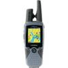
RINO 520HCx - Hiking GPS receiver / two-way radio - Color - 176 x 220