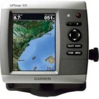
GPSMAP 526s - Marine Chartplotter - 5" color - 480 x 640
Model: 526s Brand: Garmin
The GPSMAP 526 is a compact chartplotter that features a high-resolution, super-bright 5" VGA display along with an improved high-speed digital design for increased map drawing and panning speeds. It's ready to go with a built-in, satellite-enhanced worldwide basemap.
Product Specification
-
General
Product Type: ChartplotterRecommended Use: MarineCard Reader: SD Memory CardInterface: NMEA 0183, NMEA 2000Included Software: Garmin Worldwide Marine BasemapCompatible Software: BlueChart g2 VisionAntenna: Built-inFeatures: Alarm, 2D / 3D map perspective, XM Satellite Radio support, XM weather supportFirst Seen On Google Shopping: December 2009 -
Display
Type: LCD - colorDiagonal Size: 5"Resolution: 480 x 640Features: Anti-glare -
Transducer
Transducer Presence: Included transducerTransducer Type: Dual-beam -
Navigation
Waypoints: 3000Tracks: 50Tracklog Points: 20000Routes: 100Trip Computer: Sun/moon positions -
Connections
Interfaces: Antenna - BNC -
Miscellaneous
Protection: WaterproofWaterproof Standard: IPX7Included Accessories: Protective cover, mounting bracket, power/data cable -
Dimensions & Weight
Width: 5.9 inDepth: 2.9 inHeight: 6.4 inWeight: 1.8 lbs -
Universal Product Identifiers
Part Numbers: 010-00772-01, 010-00772-02, 526sGTIN: 00753759066475, 00753759096113
Related Products
-
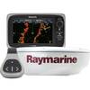
e7D 7" Multifunction Display with Sonar, Internal GPS, USA Inland Charts, RD418D Radar & No Transducer T70106 c44596
-
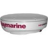
T92184 RD424HD 4KW 24 in HD Dome w/ Cable
-
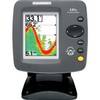
300 Series 141c - Fishfinder - included transducer : XNT-9-20-T - single-beam
-
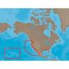
NA-M024 SD Card Format US West Coast and Haw
-
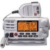
80dB Class D Fixed Mount VHF Radio Integrated AIS Receiver White
-
Ram Marine Navigation Lights (3) 05
-
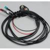
Power Bright 2 AWG 3 ft Battery Cables
-
100ft 24AWG Cat6a 500mhz Stp Ethernet Bare Copper Network Cable - Blue
-
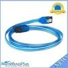
36inch SATA 6Gbps Cable w/Locking Latch - UV Blue
-
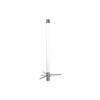
Marine Antennas - Cellular phone antenna - Marine
-
B75-0-L Broadband Chirp 0 Degree Tilt, No CONNECTOR, Depth & Temperature Thru-Hull Tilted
-
LHR-80 VHF/GPS Handheld Marine Radio, LHR80,22-17