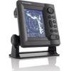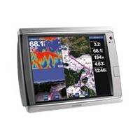
GPSMAP 7215 - Marine Chartplotter - 15" color - 1024 x 768
Model: 7215 Brand: Garmin
Put the power of Garmin's marine navigator right at your fingertips with the GPSMAP 7215. This touch screen chart plotter is the flagship in Garmin's line of full-featured marine products. The GPSMAP 7215 features with video-quality resolution on an impressive 15.5" XGA display. The GPSMAP 7215 also provides total system integration - allowing support for the addition of sonar, radar, weather and more. « less
Product Specification
-
General
Product Type: ChartplotterRecommended Use: MarineCard Reader: SD Memory CardInterface: NMEA 0183, NMEA 2000Functions & Services: Tide TabAntenna: ExternalFeatures: Alarm, XM Satellite Radio support, XM weather supportFirst Seen On Google Shopping: October 2011 -
Display
Type: LCD - color - touch screenDiagonal Size: 15"Resolution: 1024 x 768 -
Navigation
Waypoints: 5000Tracks: 50Tracklog Points: 50000Routes: 100Trip Computer: Sun/moon positions -
Connections
Interfaces: Garmin Marine Network -
Miscellaneous
Protection: WaterproofWaterproof Standard: IPX7Included Accessories: Protective cover, power cable -
Dimensions & Weight
Width: 15.5 inDepth: 5.9 inHeight: 11.9 inWeight: 17.4 lbs -
Universal Product Identifiers
Part Numbers: 010-00748-01, 7215GTIN: 00753759099381
Related Products
-
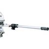
1440 Handi-Mate O.B. Handle
-
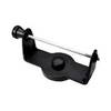
GPS receiver marine swivel mounting bracket
-
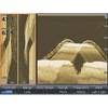
LSS-1 StructureScan Sonar Box Only (LOW-99-002)
-
1623 with 6 Inch Monochrome LCD 16 NM Radar Display with 15 Inch Radome c15218
-
Max EN-M080 W29 Germany Inland-MAX
-
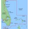
MapSource BlueChart - Jacksonville-Key West - Maps
-
Fastfind 210 - GPS Personal Locator Beacon, -40C Battery F/ Fastfind
-
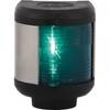
Navigation Light Starboard
-
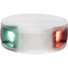
LED Bicolor Light White 12V
-
100A Marine Electrical Shore Power Blank Adapter
-
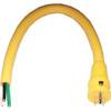
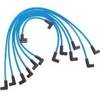
Marine Products Plug Wire Set 9-28012
-
5ft 24AWG Cat6 550mhz UTP Ethernet Bare Copper Network Cable - Green