How To Read a Nautical Chart: A Captain's Quick Guide [Book]
Your quick-reference, on-board guide to the symbology and shorthand notations used on nautical charts Nautical charts contain an incredible amount of information for those who know how to decipher them. But without a key to the symbology, a chart can be bewildering. Nigel Calder, one of today's most respected boating authors, helps you make sense complex system of signs, symbols, and graphic elements with this compact, waterproof, and nearly indestructible guide. « less
Product Specification
-
Authors: Nigel CalderPages: 16Format: paperbackPublication Date: November 11, 2008Key Terms: nautical chart, Chesapeake Bay, cardinal marks, navaids, nautical mile, Penobscot Bay, true north, day beacon, swing bridge, vector chart, NOAA chart, electronic charts, Hydrographic Office, lighthouse, magnetic north, raster chart, Kelp, spring tides, Occulting, paper charts
-
Universal Product Identifiers
ISBN: 0071592873GTIN: 09780071592871
Related Products
-
AP5009 Autopilot with AP50, J50, Rudder Feedback RF300, HLD350
-
CH270BB/224 180 kHz Black Box Searchlight Sonar System. Includes 250mm Travel Hoist and Operates at 24 and 32VDC
-
GRH44 HD Ethernet Radar Open Array 4ft 40382
-
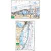
23e Miami to Card Sound - Large Print Chart
-
2798.91 FBRS 2798 Battery Replacement Service
-
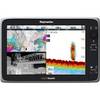
e165 15.4 Display Multifunction Coastal Chart #E70025-US
-
ICE 35 - Fishfinder - portable - included transducer : XI 9 19 - dual-beam
-
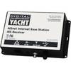
ZDIGAISNET AISnet AIS Base Station
-
DVI or VGA Interconnect Cable to (digital) 10M
-
Travel Kit USB cable with AC adapter - 4 pin USB Type A - M - PC
-
TM258-8F 1kW 50/200 kHz Transom Mount Transducer 8F Connector
-
GSD24 Digital Black Box Network Sounder 010-00957-00 c41203