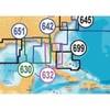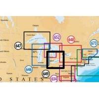
Inc MSD/649P Map, Lake Erie & Saint Clair
Model: 649P Brand: Navionics
Navionics 649P+ Lake Ontario Platinum+ Multi-Dimensional Charts, with the most advanced technology and best imaging available, provide high-resolution photo/chart overlay, full-view XGA panoramic pictures, improved 3D view, complete geo-referenced coast pilots. Compatibility Guide
Product Specification
-
Universal Product Identifiers
Part Numbers: 11093846, 37652, 649P+, DEF-257881MSD649, MSD-649P-, MSD649P+, SD649P, SD/649P+GTIN: '82124564959, 00821245649591
Related Products
-
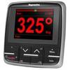
E22166 P70 Autopilot Control Head
-
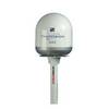
Radar Pole Mount 8' Kit for Raymarine 2KW and 4KW
-
SD642P S Car-N Florida Plat+On M155Sd
-
Canadian Charts - A, Alberni inlet/pt alberni/robbers Pa Canadian
-
Firefly 3 Waterbug Water Sensor Orange U Strob
-
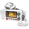
Oceanus D UM415 Fixed Mount Submersible VHF Marine Radio
-
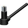
33302-7 LED Port Side Mount Black
-
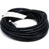
25ft 16AWG Power Cord Cable w/ 3 Conductor PC Power Connector Socket (C13/5-15P) - Black
-
CPA-138 Cell Phone Adapter Cable
-
Inc ETS0131472 Computer Hardware
-
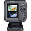
385ci Di Down Imaging GPS Fishfinder with Internal Antenna & Transom Mount Transducer 42460
-
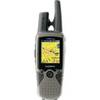
RINO 530HCx - Hiking GPS receiver / two-way radio - Color - 176 x 220