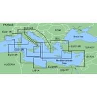
MapSource BlueChart - Aegean Sea and Sea of Marmara - Maps
Model: Brand: Garmin
MapSource BlueChart is Garmin's exclusive marine cartography and was developed to provide you with mapping flexibility and options you've never had before. This line of cartography products is designed to provide interactive viewing of detailed nautical chart data, thereby providing navigators with innovative object-oriented cartography. These detailed electronic nautical charts look just like paper charts when displayed on your Garmin chartplotter. Features include shading between depth contours, spot soundings, navaids, port plans, wrecks, obstructions, inter-tidal zones, and more. BlueChart offers much larger coverage areas for half the price. MapSource BlueChart Aegean Sea and Sea of Marmara includes all of the Greek coast and Aegean Sea; Turkey from Istanbul and Sea of Marmara to Antalya; and Brindisi, Italy. « less
Product Specification
-
General
Product Type: MapsDistribution Media: microSD Memory CardFirst Seen On Google Shopping: January 2006 -
Compatibility Information
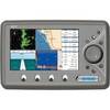
Designed For: Garmin eTrex Legend Cx, Vista Cx Garmin GPSMAP 60CSx, 60Cx, 76CSx, 76Cx -
Universal Product Identifiers
Part Numbers: 010-C0390-00, Aegean Sea and Sea of MarmaraGTIN: 00753759056193
Related Products
-
Boat (External) Wiring Harness Johnson/Evinrude OMC Yellow Plug New 473-9420 Instrument Cable Assembly
-
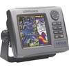
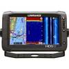
99-001 Hds5i-bndl, Hds-5, Fishfinder
-
SM-24-R Sailboat and Trawler Mast Platform
-
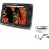
Package(e125 with USA Coastal Chart, 4KW 18 Inch Digital Radome & Radar Cable)
-
BlueChart g2 Vision - North Maine - Maps
-
4263121 Chrome Plated Cigarette/Chart
-
010-C0738-10 Bluechart G2 HUS400SWalkers Cay to Exuma Sound
-
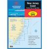
Waterproof Chart Kit - New Jersey Coast 35271
-
EC7EF Chartplotter w/External Antenna & Fishfinder Tan / Red
-
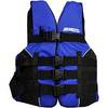
LJ-XXL - Adult Life Vest Size XXL
-
10108 Chrome Dual Trumpet Mini Air Hor
-
000-10775-001 HDS-12 Gen2 Touch Insight - No Transducer