MapSource BlueChart - Anchorage to Juneau - Maps
Model: Brand: Garmin
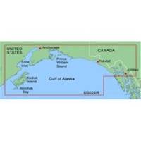
MapSource BlueChart is Garmin's exclusive marine cartography and was developed to provide you with mapping flexibility and options you've never had before. This line of cartography products is designed to provide interactive viewing of detailed nautical chart data, thereby providing navigators with innovative object-oriented cartography. These detailed electronic nautical charts look just like paper charts when displayed on your Garmin chartplotter. Features include shading between depth contours, spot soundings, navaids, port plans, wrecks, obstructions, inter-tidal zones, and more. BlueChart offers much larger coverage areas for half the price. MapSource BlueChart Anchorage to Juneau provides detailed coverage from Juneau to Alinchak Bay includes Kodiak Island, Cook Inlet, Prince William Sound, Yakutat, Glacier Bay and Icy Strait. « less
Product Specification
-
General
Product Type: MapsDistribution Media: Garmin Data CardFirst Seen On Google Shopping: January 2006 -
Universal Product Identifiers
Part Numbers: 010-C0039-00, Anchorage to JuneauGTIN: 00753759031855 -
Compatibility Information
Designed For: Garmin GPSMap 172C, 176, 176C, 178C, 178C Sounder, 182, 182C, 188 Sounder, 188C Sounder, 196, 2006, 2006C, 2010, 2010C, 2106C, 2110C, 2206C, 2210C, 232, 238 Sounder, 276C, 292C, 296, 298C, 3006C, 3010c, 3205C, 3206C, 3210C, 376C, 392C, 396C, 492C, 498C
Related Products
-
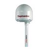
SC101 Radar Pole Mount 6' Kit for Raymarine 2KW/4KW Dome
-
Mastering Marine Radar [DVD]
-
CWP320 Instrument Companion Waypod
-
Articles on Hydrography, Including: International Hydrographic Organization, Limnology, Hydrographic Survey, Nautical Chart, Hydrographic Office, Bathymetric Chart, Territorial Waters, Canadian Hydrographic Service, Exclusive Economic Zone [Book]
-
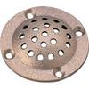
5" Round Bronze Strainer Made in The USA
-
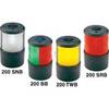
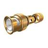
Base Mount All Round Navigation Lights Light, Red
-
SP110VF-9 SP-110 System w/Virtual Feedback & Mechanical Remote
-
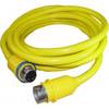
30 Amp 75' Cord Set - Yellow - 125V
-
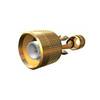
BNC-Cp/Gs-01 Connector for Rg-58Au Cable
-
TNC-Cp/Gs-01 Connector for Rg-58Ua Cable
-
12.5 Beg Generator
-
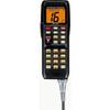
VH-310 Second Station Remote Telephone Handset