MapSource BlueChart - Carolinas - Maps
Model: Brand: Garmin
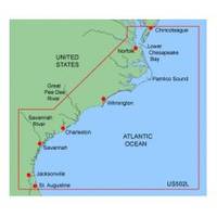
MapSource BlueChart is Garmin's exclusive marine cartography and was developed to provide you with mapping flexibility and options you've never had before. This line of cartography products is designed to provide interactive viewing of detailed nautical chart data, thereby providing navigators with innovative object-oriented cartography. These detailed electronic nautical charts look just like paper charts when displayed on your Garmin chartplotter. Features include shading between depth contours, spot soundings, navaids, port plans, wrecks, obstructions, inter-tidal zones, and more. BlueChart offers much larger coverage areas for half the price. MapSource BlueChart Carolinas covers from the Lower Chesapeake Bay at Tangier Island to St. Augustine, FL, including Norfolk, VA, Jacksonville, FL, and the entire Intracoastal Waterway between them. Also includes Albemarle Sound and the Chowan R. to Winton, NC; Pamlico Sound, Pamlico R. to Washington, NC, and Neuse R. to New Bern, NC; Savannah R. to Augusta, GA; and the St. Johns R. to Federal Pt., FL. « less
Product Specification
-
General
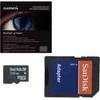
Product Type: MapsDistribution Media: microSD Memory CardFirst Seen On Google Shopping: January 2006 -
Compatibility Information
Designed For: Garmin eTrex Legend Cx, Vista Cx Garmin GPSMAP 60CSx, 60Cx, 76CSx, 76Cx -
Universal Product Identifiers
Part Numbers: 010-C0377-00, CarolinasGTIN: 00753759056063
Related Products
-
GPS receiver marine swivel mounting bracket
-
GMR 604 XHD Radar - 4 ft. 6KW Pedestal Array
-
NSE8 Navigation Package NSE-8, GS-15 GPS Antenna and 3G Radar
-
E52081E - 4KW Super HD Digital Pedestal w/ VCM100
-
BlueChart g2 Vision - New York - Maps
-
9426a 17 Cable Harness F RCL-75
-
AP2403VRF Autopilot AP24 AC12 RC42 RPU80
-
Marine 2 NM Stern Lamp
-
Lopo Light Masthead (3nm)
-
35ft Premier Series XLR Male to 1/4inch TRS Male 16AWG Cable (Gold Plated)
-
P30 30 Amp Cover Plate for Receptacle (Gray)
-
34170 Vhf-200 VHF Radio W/class-d DSC