Marine World Chart of Nicolo de Canerio Januensis... [Book]
This is a reproduction of a book published before 1923. This book may have occasional imperfections such as missing or blurred pages, poor pictures, errant marks, etc. that were either part of the original artifact, or were introduced by the scanning process. We believe this work is culturally important, and despite the imperfections, have elected to bring it back into print as part of our continuing commitment to the preservation of printed works worldwide. We appreciate your understanding of the imperfections in the preservation process, and hope you enjoy this valuable book. ++++ The below data was compiled from various identification fields in the bibliographic record of this title. This data is provided as an additional tool in helping to ensure edition identification: ++++ Marine World Chart Of Nicolo De Canerio Januensis; Marine World Chart Of Nicolo De Canerio Januensis; Edward Luther Stevenson Edward Luther Stevenson, American Geographical Society of New York, Hispanic Society of America Hispanic Society of America, 1908 Reference; Atlases; Early maps; Nautical charts; Reference / Atlases; World maps « less
Product Specification
-
Authors: Edward Luther Stevenson, American Geographical Society of New Yor, Hispanic Society of AmericaFormat: paperbackPublication Date: February 22, 2012
-
Universal Product Identifiers
ISBN: 1275700233GTIN: 09781275700239
Related Products
-
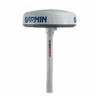
Radar Pole Mount 6' Kit for Garmin/Furuno Domes 36177
-
Mini CDC Chart F/ 1650-1850
-
Chapman Nautical Chart No. 1: The Essential Guide to Chart Reading and Navigation [Book]
-
FBRS 2775 Battery Service Includes 1096 Batt Parts Labor
-
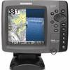
788ci HD Di Combo Down Imaging w/TM Transducer
-
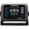
00010778001 HDS-7 Touch G2 Insight W-Lss
-
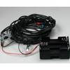
Radio CONTROLLED models 14 Big Plane Navigation Lights 9V 3
-
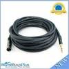
50ft Premier Series XLR Male to 1/4inch TRS Male 16AWG Cable (Gold Plated)
-
LTD 50F1 50 Amp 125 Volt Female Connector
-
5 Inch Power Mount Forward Lean Universal Mount with Light Bracket Option PMF-5U-7L (PMF-57-M1 + ADA-R1) wpmf5u7l
-
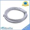
14ft 24AWG Cat6 550mhz UTP Ethernet Bare Copper Network Cable - White
-
3ft 24AWG Cat6 500mhz Crossover Ethernet Bare Copper Network Cable - Gray