Max AN-M202 W50 Korea Strait, Okinawa Shima-MAX
Model: AN-M202 Brand: C-Map
Product Specification
-
Universal Product Identifiers
Part Number: AN-M202
Related Products
-
AP50 Autopilot with AP50, J50-40 (40 Amps), Rudder Feedback RF300
-
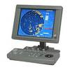
JMA-5104 Black Box Radar 48 NM with 4KW 24 Inch Dome without Display
-
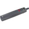
Tiller Autopilot St-1000+ A12004
-
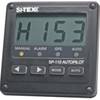
SP110RF-3 System with Rudder Feedback and Type S Mechanical Das
-
SD699P N Bahamas Plat + on M155-Sd
-
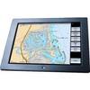
GB40 15 Inch Glass Bridge Navigation System (Requires GPS Antenna)
-
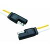
MOLEX to Dual 4-Pin Floppy Power Adapter Cable - MR1314
-
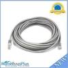
25ft 24AWG Cat5e 350MHz UTP Bare Copper Ethernet Network Cable - Gray
-
Prod 13841 Molded Line Connector
-
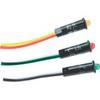
Amber LED, 12 Volt DC, 8033
-
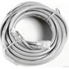
25' Network Cable for Scp Remote Panel 809-0940
-
Livorsi Gpss100K1Cfpssrr 3 3/8 GPS 100 MPH Kit Black CF