Max Mega Wide International cmegai
Model: Brand: C-Map
Dynamic tides and currents predict the time, level, direction and strength of currents and tides. Guardian Alarm performs an automatic forward-scanning check for obstacles. Use this feature as an added backup to alert you if you head toward a potentially harmful object. Photos and diagrams in high-definition of ports, marinas and significant navigational marks will help you to familiarize yourself with new destinations and passages. Route-check is an extension of Guardian Alarm, helping keep you safe by indicating obstacles along the segments between waypoints. Depths and land elevation show the usual depth information and the colors make it easy to distinguish different water depths and land elevations. Detailed harbor charts so docking in unfamiliar ports is no problem. You have precise layouts of thousands of marinas, including slip spaces, restricted areas and other valuable navigation information. Perspective view gives a bird's-eye view of your navigation area, it tilts the chart view to a 45-degree angle. C-Marina Port Database has details on more marinas than other charts on the market. Multi-language capability All C-MAP by Jeppesen charts can be displayed in both English and the local language of each region. « less
Product Specification
-
Universal Product Identifiers
Part Number: cmegai
Related Products
-
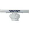
IR2 6.4 6KW 4.5 Foot Open Array Radar R-0007
-
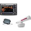
Package(E90W, GPS Antenna, DSM300G Sounder, RA1048D 4KW 48 Inch HD Digital Open Array Radar & 15m Radar Cable )
-
9368a Antenna F RapidFix Sat II
-
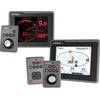
E22115 ST70 Plus Multifunction Instrument Display
-
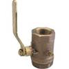
Inline Valve, 1/2 Inch Pipe
-
Practical Marine Navigation [Book]
-
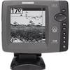
700 Series 728 - Fishfinder - included transducer : XNT-9-20-T - dual-beam
-
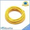
30ft 24AWG Cat6 550mhz UTP Ethernet Bare Copper Network Cable - Yellow
-
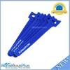
Hook & Loop Fastening Cable Ties 6inch, 50pcs/Pack - Blue
-
80404 Fuel Connector
-
18-8062 Fuel Line Connector 5/16"
-
5 Inch Power Mount Forward Lean Universal Mount with Light Bracket Option PMF-5U-7L (PMF-57-M1 + ADA-R1) wpmf5u7l