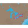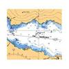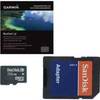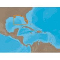
NA-C401 C-Card Format - St. Lucie Inlet LK Pontch
Model: NA-C401 Brand: C-Map
C-MAP has set the standard for electronic charts with five consecutive NMEA awards for "Best Electronic Cartography". Built on the incredible success of C-MAP NT+, NT+ Wide combines a generation of chartplotters with efficient performance plus real-time accuracy and detail. Now you will be able to see slip detail as well as the locations for onshore facilities. « less
Product Specification
-
Universal Product Identifiers
Part Numbers: 19562, M-NA-C401, NA-C401C-CARDGTIN: 000000099675
Related Products
-
AP5010 Autopilot with AP50, J50, Rudder Feedback RF300, HLD350S
-
385cxi Fishfinder GPS Combo - International Unit
-
Package(e127 with USA Coastal Chart, 4KW 18 Inch Digital Radome & Radar Cable)
-
NA-C103 Furuno FP Format - Erie, Ontario & Trent Severn
-
NA-C202 Furuno FP Format - St. Lawrence Rideau Champlain
-
Canadian Charts - N amp; O, Otter passage-bonilla Island Canadian
-
010-C0879-20 Bluechart G2 HXAE004RHong Kong/South China Sea
-
Deck Plates, Fills for Pipe, 2-1/2", Unmarked, Bronze
-
14ft 24AWG Cat6 500mhz Crossover Ethernet Bare Copper Network Cable - Gray
-
Cat6a Ethernet Cable | 7ft | Blue | Network | 10 Gigabit
-
GPSMAP 5208 - Marine GPS receiver - 8.4" color - 640 x 480
-
RINO 130 - Hiking GPS receiver / two-way radio - Monochrome - 160 x 160