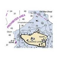
NOAA Cape Blanco-Yaquina Head
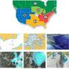
Dept. of Commerce - 18580; NOAA nautical charts Encompasses the Pacific Coast of Oregon Note: Ensure that your charts are kept current to reflect changes to that area
Product Specification
-
Universal Product Identifiers
Part Number: 18580
Related Products
-
8' Radar Mast Pole Kit with One Stand-Off Kit RM8KT1
-
S1000 Autopilot Wireless 8.5 Max Ram 12169
-
HDS-5m Nautic Insight Chartplotter - Coastal Data 34262
-
CH250BB/88/225 88 kHz Black Box Searchlight Sonar System. Includes 250mm Travel Hoist and Operates at 12VDC
-
Part #407990-1 | 1198c Si Combo
-
MDS-9 4KW 24 Inch Dome Black Box Radar with 10 Meter Cable wmds9
-
37637 HotMaps Platinum Multi-Dimensional 3D Lake Maps
-
SOLARA-DSC Black Solara Compact Fixed Mount VHF 2-Way Marine Radio - Black
-
SmartCast RF25 - Fishfinder - portable - included transducer : RF45 - single-beam
-
000-10787-001 RS12 DSC VHF Radio
-
USB 3.0 Micro Cable | 15ft | Type A | Micro Type B | Black
-
FCF16000 Kit with AC, Seawater & Ducting - 115V FCFK022A