NT+ Wide Chart (European Region & Middle East)
Model: Brand: C-Map
NT+ C-card technology is reverse-compatible with current NT charting systems. Full benefits of improved chart display are optimized on systems Designed for NT+ (or by updating your NT system software to NT+). Vastly Expanded Coverage: Important advances in technology now permit C-MAP to offer significantly increased coverage areas without sacrificing compatibility or performance with current C-card based navigating systems. This has, in turn, resulted in much more coverage at a much lower cost! Extra Information Not Found On Official Government Charts: True Color NavAids - Extensive NavAid information, allowing for on-screen display in true shapes and colors. Port Info - Complete and detailed databases of port facilities, services and contact information. Tide Info - NT+ C-cards include primary and secondary tidal stations that can be queried for easy access while navigating. Easy-to-read graphs display depth at high and low water for sun-up and sun-down. Tidal predictions make travel planning easier and safer. Improved Chart Display: Paper Chart Appearance - All the advantages of electronic charts with the familiar look of a paper chart. C-MAP's experience with professional navigation and highly effective chart display has resulted in a new chart look for NT+. This new look makes creative use of colors, patterns and icons to increase the familiarity and usability of the content-rich NT+ database. New NavAid Symbols and Styles - Depending upon navigation situations and mariner's preference, Aids to Navigation can now be configured for three basic styles: INTERNATIONAL - NavAids shown in real life shapes and colors for quick visual recognition (as per official paper chart presentations). UNITED STATES - NavAids shown in simplified shapes and real colors (as generally found on NOAA paper charts). SIMPLIFIED - NavAids shown in generic symbols for minimum visual clutter on-screen. SIMPLE - Some selections are turned off, such as Light Sectors, Seabed Type, Tracks & Routes, Lat/Lon Grid. FISHING - Turns off even more selections, like Tides & Currents, Ports & Services, Rivers & Lakes, Chart Boundaries. CUSTOM - The navigator selects which features he'd like on the screen. What are the Differences Between NT+ Local, Wide & SuperWide C-cards? Simply put, the differences lie in the C-cards geographical coverage and pricing. They differ only in the amount of the boating area that the individual NT+ C-card covers. « less
Product Specification
-
Universal Product Identifiers
Part Number: c11206euro
Related Products
-
Rsb118092 4KW Gearbox for Drs4a Openarray System
-
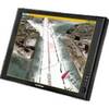
Nauticomp Signature 15 Inch Sunlight Marine Display, Flush Mount
-
Canadian Charts Sunshine Coast
-
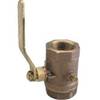
Inline Valve, 1 1/2 Inch Pipe
-
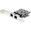
Pcie 2X RJ45 1000-Base T Gigabit Ethernet Card, Realtek Chipset
-
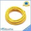
30ft 24AWG Cat6 550mhz UTP Ethernet Bare Copper Network Cable - Yellow
-
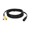
VC 1 - Video cable
-
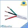
250ft 12AWG CL2 Rated 4-Conductor Loud Speaker Cable (for In-Wall Installation)
-
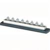
2107 PowerBar 600 Ampere Cable Connector 8 x 3 8 16 Stud ter
-
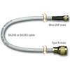
Digital 100' DA340 Cable w/Connectors
-
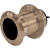
B117-DT-8 600W Thru Hull Transducer Furuno 8-Pin Fuji Connector
-
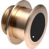
B175-12-L Broadband CHIRP, No CONNECTOR, Depth & Temperature Thru-Hull Tilted