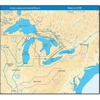
NT+ Wide Map, Mississippi and Illinois Rivers
Model: Brand: C-Map
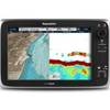
C-MAP has set the standard for electronic charts with five consecutive NMEA awards for "Best Electronic Cartography". Built on the incredible success of C-MAP NT+, NT+ Wide combines a generation of chartplotters with efficient performance plus real-time accuracy and detail. Now you will be able to see slip detail as well as the locations for onshore facilities. « less
Product Specification
-
Universal Product Identifiers
Part Number: NA-C040GTIN: 00686074004016
Related Products
-
958c Combo 36983
-
T70033 C127 Multifunction Display w/Sonar - European Charts
-
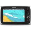
T70027 C97 Multifunction Display W Sonar - US Inland Charts
-
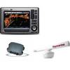
Package(E90W, GPS Antenna, DSM300G Sounder, RA1072HD 4KW 72 Inch HD Digital Open Array Radar & 15m Radar Cable )
-
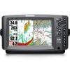
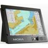
900 Series 957c Combo - Marine Chartplotter - 8" color - 800 x 480 - widescreen
-
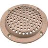
6" Round Bronze Strainer Made in The USA
-
Methods and Algorithms in Navigation: Marine Navigation and Safety of Sea Transportation [Book]
-
Navigation Light [Book]
-
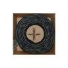
Bulk cable - CAT 6 - Unshielded twisted pair (UTP) 1000 ft - Black
-
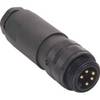
M1A5006-34DN Mini Field-Attachable Connectors (Male)
-
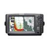
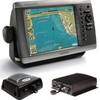
GPSMAP 4208 Network Bundle Includes GSD22 & Gxm51
-
MPC-122-K Series: X86 Marine Panel computers with Intel Core 2 Duo 2.26 GHz, VGA, 2 Gigabit LANs, CompactFlash