PAPR06; Region 6 Paper Chart Kit
Model: PAPR06 Brand: Maptech
ChartKits are full-color reproductions of U.S. government and private charts spiral bound into popular cruising regions with aerial photos, pre-plotted courses and more. The convenient-sized books are large enough to allow for manual plotting, yet small enough to sit on your nav-station or lap. Waterproof covers are available. « less
Product Specification
-
Universal Product Identifiers
Part Number: PAPR06
Related Products
-
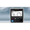
NAVPILOT 711 Autopilot for Inboard without Pumpset
-
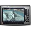
788ci High Definition Combo Cho Display Only 39686
-
C97 Multifunction 9" Display with Sonar - European Charts T70023 c44025
-
BlueChart g2 Vision - Wrangell / Juneau / Sitka - Maps
-
2844 Globalfix Pro 406 EPIRB Integral GPS - Category 2
-
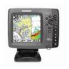
E120W Chartplotter U.S. Coastal Charts E62223-US
-
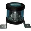
Orca Green Marine LED Masthead / Anchor Navigation Light 9385337
-
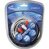
Audiopipe Ip2rca3 2 Ch Marine Oxygen Free RCA Cable 3 ft 2 Channel
-
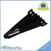
Hook & Loop Fastening Cable Ties 6inch, 100pcs/Pack - Black
-
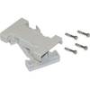
Cable Showcase 3508-009 Plastic Hoods for DB9 to DB9
-
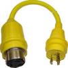
30 Amp to 20 Amp, 125 Volt Straight Adapter, Yellow A3020S
-
MRHH 125 Marine VHF Radio