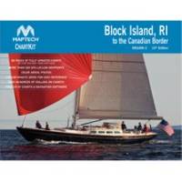
PAPR08; Region 8 Paper Chart Kit
Model: PAPR08 Brand: Maptech
ChartKits are full-color reproductions of U.S. government and private charts spiral bound into popular cruising regions with aerial photos, pre-plotted courses and more. The convenient-sized books are large enough to allow for manual plotting, yet small enough to sit on your nav-station or lap. Waterproof covers are available. « less
Product Specification
-
Universal Product Identifiers
Part Number: PAPR08
Related Products
-
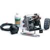
Cylinder Bracket Kit for TR-1 Gold Autopilots
-
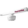
T52087 4KW 72quot; Open Array Super HD W/15M Cable
-
2774NH.91 FBRS 2774NH Non-Hazmat Battery Replacement S
-
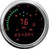
2000 Series Tank Mount Instrument Replacement - 4-1/2 Inch Speedometer/Tachometer with Direct ECM Plug-in for Harley Davidson Road King 2004-2012 / Softail 2004-2010 - Red - MCL-2004-R
-
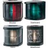
2984 Port Lamp 62209
-
Shore Power Cable 6/4 White Per ft
-
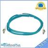
10gb Fiber Optic Cable, LC/LC, Multi Mode, Duplex - 3 Meter
-
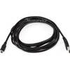
10ft USB A to Mini-B 5pin 28/28AWG Cable
-
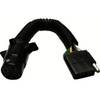
Anderson Marine V5412 4 to 4-Way Harness Adapter 8"
-
T&H Marine -SA-2B-DP Scupper Blk/White
-
SBBL Switch Box 2 Ducers1 Unit Blue Connector
-
A62245 1.5m SeaTalk HS Cable Waterproof Connector