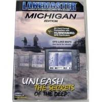
ProMap Michigan Version 2 f/Humminbird HPMIC2
Model: HPMIC2 Brand: Lakemaster
Map Michigan Version 2 for Humminbird - Part #: HPMIC2The Lake - The Michigan chip is loaded with 717 total lakes with contours, of which 86 are high definition Lake - Map lakes. Waters -5 ft contours -St. Clair - 3ft Contours -Saginaw Bay & St. Marys River - 3ft Contours -Little Traverse Bay, Grand Traverse Bay Lake Huron -All Huron U.S. Waters -5 ft contours -St. Clair - 3ft Contours -Saginaw Bay & St. - Master GPS charts. - For 2009 and older Humminbird GPS/Sonar models, you will be required to download an update from the Humminbird Website www.humminbird.com. Once you have registered your product you will have access to the update, which willrequire you to download a file to a blank SD card. After the download is complete, insert the SD card into your GPS unit, follow the on screeninstructions, and your unit will now display the Lake « less
Product Specification
-
Universal Product Identifiers
Part Number: HPMIC2
Related Products
-
AP5013 Autopilot with AP50, J50, Rudder Feedback RF300, HLD2000SD (Short Stroke, Dual)
-
E32153 Raystar 130 GPS Antenna
-
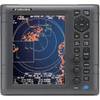
Package(e95 with USA Coastal Chart, 4KW 24 Inch Digital Radome & Radar Cable)
-
1935 4KW 3.5 Open Array Color LCD Radar 37418
-
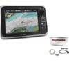
010-00751-01 - GPSMAP 6212, 12 MFD, Coastal Map
-
High Performance Marine Heading Sensor NMEA 0183 Cable
-
90 Marine Navigation ParaLock Plotter
-
646 25ft 3.5mm Stereo Plug/Plug M/M Cable - Black
-
300ft 16AWG Enhanced Loud oxygen- Copper Speaker Wire Cable
-
Marine Products Plug Wire Set 9-28038
-
3ft 24AWG Cat5e 350MHz UTP Bare Copper Ethernet Network Cable - Red
-
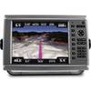
CPN1010i 10 in. Networking GPS with WiFi Preloaded