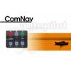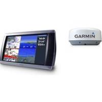
Radar 5215 Package with GMR18 4KW Radome
Model: GMR18 Brand: Garmin
The package includes Garmin GPS Chartplotter Garmin GPS Antenna Garmin Radome Garmin Power, GPS, and Radar cables Manuals The largest network plotter display in the Garmin marine line, the GPSMAP 5215 offers true big picture? navigation. This chartplotter features the same menu-driven touchscreen found on its 5,000 series counterparts. Preloaded BlueChart g2 maps of the U.S. coast and a whopping 15" screen make navigation as easy as pointing your finger. By connecting to the Garmin Marine Network, you can add sonar, radar and weather. And for even more advanced features, you can add the optional BlueChart g2 Vision card. View Detailed Graphics and Video The GPSMAP 5215 features highly-detailed BlueChart g2 marine cartography of the coastal United States, including Alaska, Hawaii and the Bahamas. For other areas, the 5215 has a worldwide basemap with high-quality satellite images in place of more traditional maps. With the SD card slot, you can add additional maps without having to connect to a computer. The 5215? s huge XGA screen displays graphics with crisp, video-quality resolution. To keep tabs on your engine room or another area of your boat, you can also connect a live video feed with the 5215's video input/output options. Add Extras with BlueChart g2 Vision With optional BlueChart g2 Vision SD cards, you can add a whole new dimension of exceptional features to your chartplotter. Choose to view 3D map information at "mariner's eye view" above the waterline or "fish eye view" below the water. High-resolution satellite images and aerial photographs help you orient yourself in unfamiliar areas. Auto Guidance technology searches through all relevant charts to create a route you can actually follow one that avoids obstacles, shallow water, buoys and other obstructions. Connect to the Garmin Marine Network The 5215 connects easily to the high-speed Garmin Marine Network, so you can interface with additional MFDs and add remote sensors. Once connected, you can share information between the 5215 and other chartplotters on your boat. You can also add high-powered radar, sonar, and XM satellite weather and radio to your system. "Turn right in 500 ft."): no Remote control: yes (optional) Headphone jack/audio line-out: no Audio/video input/output: yes Portable: no Automotive/motorcycle-friendly: no Additional: Interface Inputs/Outputs: 3 built-in network ports, 4 NMEA 0183 inputs, 2 NMEA 0183 outputs, and NMEA 2000; 2 video inputs for onboard cameras, 1 XGA PC monitor video output What's in the Box: GPSMAP 5215 Protective front cover Top & bottom snap covers Video cable assembly Power cable assembly NMEA 0183 cable NMEA 2000 drop cable NMEA 2000 power cable NMEA 2000 T-connector & terminator kit Flush mount hardware Flush mount gasket Marine grommet kit Owners manual on disk Quick reference guide Installation instructions GPSMAP 5215 Part Number: 010-00692-11 Manuals Important Safety and Product Infomation (Multilingual), Rev. D, Jan, 2008 | Download NMEA 2000 Network Fundamentals, Rev. A, Jan, 2008 | Download Owner's Manual, Rev. B, Jan, 2008 | Download Quick Reference Guide, Rev. B, Jan, 2008 | Download EL Quick Reference Guide (Greek), Rev. B, Jan, 2008 | Download RU Quick Reference Guide (Russian), Rev. B, Jan, 2008 | Download Some downloads may require Adobe Acrobat Reader. Download a free copy here . « less
Product Specification
-
Universal Product Identifiers
Part Number: gmrpack33
Related Products
-
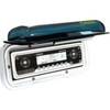
Electronics - F-MH - Marine Stereo Housing
-
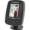
116-05 M68C S/Map - No Transducer 116-052
-
Escort 90Deg SCANNING Sonar with Transom Mount Transducer U1-ESCT-00A escorta
-
Package(e97 with aus, NZ, S. America, Asia Chart, 4KW 24 Inch Digital Radome & Radar Cable)
-
2844 Globalfix Pro 406 EPIRB Integral GPS - Category 2
-
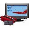
10070001 - 1420 System w/ Morse Cable Drive
-
15ft USB A to Mini-B 5pin 28/28AWG Cable
-
6ft 32AWG Mini DisplayPort | Thunderbolt to VGA Cable - White
-
Patch cable - CAT 6 - RJ-45 - M - Unshielded twisted pair (UTP) 7 ft - Gray
-
Guest 729830-P Second Station Kit
-
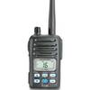
IC-M88-IS Intrinsically Safe Handheld VHF Marine Radio
-
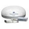
TracVision R6DX System w/ Multiservice Box Only Dish 32911