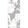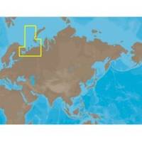
RS-C209 C-Card Format - White Sea Barents Sea East F
Model: RS-C209 Brand: C-Map
White Sea - Barents Sea East Fishing: Russia coverage from Ostrovnoy to Amderma. Also covers Yuzhny Island.
Product Specification
-
Universal Product Identifiers
Part Number: RS-C209C-CARD
Related Products
-
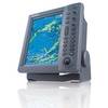
FR8062 12.1 Inch 6KW, 72 nm, 12.1 Color Display Radar 4' Open Array Antenna fr80624
-
Max EW-M225 W15 France Inland-MAX
-
Max EW-M227 W3 Norhtwest European Coasts-MAX
-
Marine Navigation: Piloting and Celestial and Electronic Navigation [Book]
-
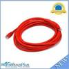
14ft 24AWG Cat6 550mhz UTP Ethernet Bare Copper Network Cable - Red
-
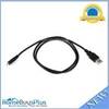
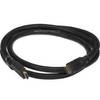
USB 2.0 A Male to Micro-B Male Cable 3 ft.
-
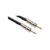
20' 1/4" Phone Male to 1/4" Phone Male Speaker Cable, 14 Awg, with 2 Conductors
-
5ft 24AWG CL2 High Speed HDMI Cable w/ Net Jacket - Black
-
3ft 24AWG Cat5e 350MHz UTP Bare Copper Ethernet Network Cable - Gray
-
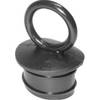
PP118DP Push Plug for 1-1/8 & 1-1/4
-
7ft 24AWG Cat6 500mhz Crossover Ethernet Bare Copper Network Cable - Gray
-
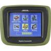
CrossoverGPS 2500T - Marine, hiking, automotive GPS receiver - 3.5" color