Waterproof Charts 123F Coastal Miami Trolling Chart - FISH/DIVE
Model: 123F Brand:
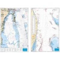
Pierce south to Key Largo and offshore to the West Bahamas, this chart is derived from 6 different Bathymetric charts which show detailed bottom contour thru the deepest water. Highlighted are popular trolling areas with their local names, which provide the structure for the best deep water, fishing. Over 100 GPS coordinates provide targets for trolling fishermen. The reverse side is coverage from North Miami to Elliot Key and has listings for 85 popular wrecks and reefs, many with GPS/Loran Waypoints. A total of 215 numbers!! 25 x 38 « less
Product Specification
-
Universal Product Identifiers
Part Number: 123F
Related Products
-
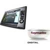
Package(E140W, GPS Antenna, 4KW 18 Inch Digital Radome & Radar Cable )
-
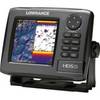
000-10515-001 HDS-5 Gen2 Lake Insight 83200khz Marine Electronics
-
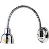
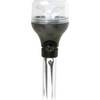
Marine Lighting, LED, Bulkhead Mount, Ocean Chart Lamp, 10 - 30V DC, Medium, Stainless Steel Finish, Warm
-
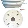
ADA-M31 Dual Mount Adapter f/KVH M1 Map
-
5500 Series LED All Around Navigation Lights 54" Straight Pole
-
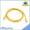
5ft 24AWG Cat5e 350MHz UTP Bare Copper Ethernet Network Cable - Yellow
-
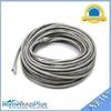
50ft 24AWG Cat6 550mhz UTP Ethernet Bare Copper Network Cable - Gray
-
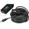
6149 32ft 10M USB 2.0 A Male to A Female Active Extension / Repeater Cable (Kinect & PS3 Move Compatible Extension)
-
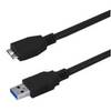
USB 3.0 Micro Cable | 10ft | Type A | Micro Type B | Black
-
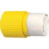
HBL328DCC 30amp 28V DC Yellow Locking Connector Body - Female
-
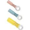
1614g 14 100 Pcs Ring Heat Shrink Connector Blue
-
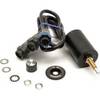
SBBL Switch Box 2 Ducers1 Unit Blue Connector