010-C0760-10 Bluechart G2 HEU001REnglish Channel Data Card
Model: 010-C0760-10 Brand: Garmin
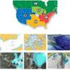
British coast: covers from Felixstowe to the Isles of Scilly, including Dover, The Solent, and the Isle of Wight. Also covers the River Thames from Twickenham to the North Sea. French coast: covers from Dunkerque to L'Aber Wrac'h, including Rouen and the Channel Islands. See your surroundings more clearly with BlueChart g2 data. With BlueChart g2, you'll get detailed marine cartography that provides convenient viewing of nautical content. BlueChart g2 allows you to see your vessel's precise, on-chart position in relation to naviads, coastal features, anchorages, obstructions, waterways, restricted areas and more. You will also have access to detailed mapping capabilities that include Safety Shading , Fishing Charts , smooth data transition between zoom levels, harmonious transition across chart borders, and reduction of chart discontinuities. « less
Product Specification
-
Universal Product Identifiers
Part Numbers: 010-C0760-10, 10804748, 35593GTIN: 00753759091439
Related Products
-
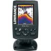
Elite-4x Color Fishfinder
-
GMR 604 XHD Radar - 4 ft. 6KW Pedestal Array
-
37636 HotMaps Platinum Multi-Dimensional 3D Lake Maps
-
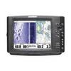
1100 Series 1197c SI Combo - Marine Chartplotter - 10.4" color - 800 x 600
-
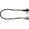
E25024 Console Mounting Bracket - ST40 INSTRUMENTS
-
GA-0100070520 - GHP 10V Autopilot Corepack (Volvo Ips)
-
Sonic Hub Marine Audio Server for NSE
-
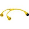
PH50 50 Foot Phone Cable Set (Yellow)
-
HBL64CM57 Y Adapter 2 30A Cords - 50A 125V Dock
-
DA75S - Antenna Adapter Cable, Sierra Wireless
-
Marine -9-72652 PLUG,DRAIN - Magnet
-
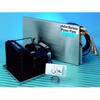
Barbour Air Cooled Power Plate PB100134