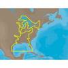
010-C0762-10 Bluechart G2 HEU003RGreat Britain Northeast
Model: 010-C0762-10 Brand: Garmin
Covers from the Isle of Lewis, Scotland to Bridlington Harbour, England, including Gairloch, the Shetland Islands, Edinburgh, and North Sea offshore charts. Also includes the Caledonian Canal, Loch Linnhe, and Loch Ness. See your surroundings more clearly with BlueChart g2 data. With BlueChart g2, you'll get detailed marine cartography that provides convenient viewing of nautical content. BlueChart g2 allows you to see your vessel's precise, on-chart position in relation to naviads, coastal features, anchorages, obstructions, waterways, restricted areas and more. You will also have access to detailed mapping capabilities that include Safety Shading , Fishing Charts , smooth data transition between zoom levels, harmonious transition across chart borders, and reduction of chart discontinuities. « less
Product Specification
-
Universal Product Identifiers
Part Numbers: 010-C0762-10, 10804805, 35597GTIN: 00753759091477
Related Products
-
XN13A/6 - 6 Foot Open Array Antenna
-
Package(C120W, DSM300G Sounder, RA1072HD 4KW 72 Inch HD Digital Open Array Radar & 15m Radar Cable)
-
30128 Max - U.S. Gulf Coast and Inland Rivers - C-Card
-
SM-18-R Mast Platform 18 in. Radome Raymarine
-
Inc MSD/652P Map, Lake Huron
-
MapSource BlueChart - Red Sea - Maps
-
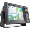
GP1920C-NT VX2 Chartplotter C-Map NT
-
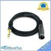
3ft Premier Series XLR Male to 1/4inch TRS Male 16AWG Cable (Gold Plated)
-
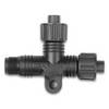
010-11078-00 - NMEA 2000 T-Connector
-
Marine Products Plug Wire Set 9-28054
-
130211-1 St 14D Dish Network or Bell TV with 50ft Cable
-
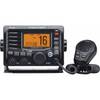
VHF Fixmt Class D DSC - Black