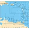
010-C0764-10 Bluechart G2 HEU005RIreland West Coast Data Card
Model: 010-C0764-10 Brand: Garmin
Detailed coverage of the west coast of Ireland from Cork Harbour to Belfast. Also covers the Scottish coast from the Isle of Colonsay to Campbeltown Harbour. See your surroundings more clearly with BlueChart g2 data. With BlueChart g2, you'll get detailed marine cartography that provides convenient viewing of nautical content. BlueChart g2 allows you to see your vessel's precise, on-chart position in relation to naviads, coastal features, anchorages, obstructions, waterways, restricted areas and more. You will also have access to detailed mapping capabilities that include Safety Shading , Fishing Charts , smooth data transition between zoom levels, harmonious transition across chart borders, and reduction of chart discontinuities. « less
Product Specification
-
Universal Product Identifiers
Part Numbers: 010-C0764-10, 10804854, 35601GTIN: 00753759091514
Related Products
-
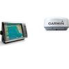
Radar 4212 Package with GMR18 4KW Radome
-
A28 Imray Guadeloupe Marine Nautical Chart
-
010-C0760-10 Bluechart G2 HEU001REnglish Channel Data Card
-
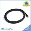
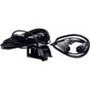
9388 GPS Interface Cable
-
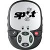
Spot 2 Satellite GPS Messenger - Silver Gloss Silver
-
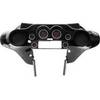
Instrument Package for Harley-Davidson Fairing models 2004-2012 - Red LED MCL-3006-R
-
7ft 24AWG Cat5e 350MHz UTP Bare Copper Ethernet Network Cable - Black
-
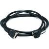
8ft db9/data Token Ring Cable
-
NSO15 Package - Monitor, Marine Processor, Remote, and SD Card Reader 41216
-
SP-X Speed Probe X-Series Connector wspx
-
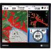
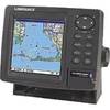
GlobalMap 5200C - Marine GPS receiver - 5" color - 480 x 480
-
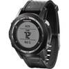
fenix - Hiking, cycle, running GPS receiver - Monochrome - 70 x 70