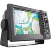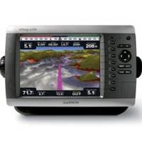
GPSMAP4208 Plotter
Model: GPSMAP4208 Brand: Garmin
This preloaded, offshore chartplotter combines the power of networking with brilliant color and slim-line design. The GPSMAP 4208 has preloaded BlueChart g2 maps of the U.S. coast and displays them on an 8.4" VGA display with video-quality resolution. By connecting to the Garmin Marine Network, you can add sonar, radar and weather. For even more enhanced features, you can add the optional Bluechart g2 Vision card. View Detailed Graphics and Video The 4208 features highly-detailed BlueChart g2 marine cartography of the coastal United States, including Alaska, Hawaii and the Bahamas. This data provides detailed coastlines, shaded depth contours, navaids, port plans, wrecks, restricted areas and tide and current information. For other areas, the 4208 has a worldwide basemap with high-quality satellite images in place of more traditional maps. With the SD card slot, you can add additional maps without having to connect to a computer. The 4208's high-speed processor draws maps quickly , and its simple intuitive interface makes navigating easy. Add Extras with BlueChart g2 Vision With the optional BlueChart g2 Vision SD card, you can add a whole new dimension of exceptional features to your chartplotter. 3D mariner's eye view or fish eye view provides you with a 3-dimensional perspective of map information, both above the waterline and below it. High-resolution satellite images and aerial photographs help you orient yourself in unfamiliar areas. Auto guidance technology searches through all relevant charts to create a route you can actually follow - one that avoids obstacles, shallow water, buoys and other obstructions. Connect to the Garmin Marine Network The 4208 connects easily to the high-speed Garmin Marine Network, so you can interface with additional MFDs and add remote sensors. Once connected, you can share information between the 4208 and other chartplotters on your boat. You can also add high-powered radar, sonar and XM satellite weather and radio to your system. « less
Product Specification
-
Universal Product Identifiers
Part Number: GAR0100059101
Related Products
-
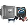
p70R & X-10 Corepack & Type 1 Pumpset Autopilot Package for Hydraulic Steered Powerboats T70079 c44130
-
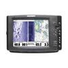
1100 Series 1197c SI Combo CHO - Marine Chartplotter - 10.4" color - 800 x 600
-
CH250BB/150/340 150 kHz Black Box Searchlight Sonar System. Includes 400mm Travel Hoist and Operates at 24 & 32VDC
-
T62291 C Series Widescreen System Packs
-
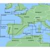
MapSource BlueChart - Irish Sea - Maps
-
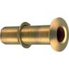
0348DP6PLB Thru Hull Connector 1in BRZ
-
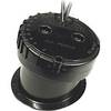
49450200Es InHull Transducer
-
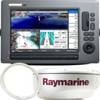
GP1920C-NT VX2 Chartplotter C-Map NT
-
6273 15ft Optical Toslink 5.0mm OD Audio Cable
-
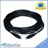
35ft Super VGA M/F CL2 Rated (for In-Wall Installation) Cable w/ Ferrites (Gold Plated)
-
MD-124Z 24 Inches Marine Display with 16:9 Aspect Ratio. Full HD (1920x108
-
18-8803-2 Premium Marine Spark Plug Wire Leads